
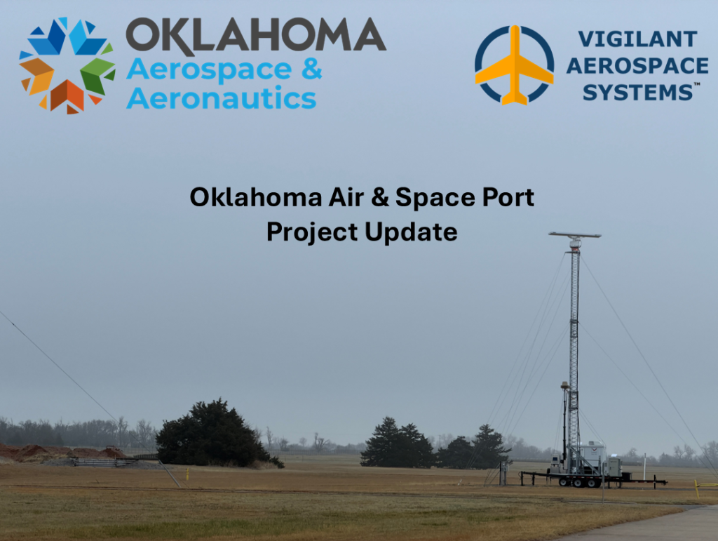
Vigilant Aerospace Deploys Airspace Safety System with Radars at Oklahoma Air & Space Port
BURNS FLAT, OK March 31st, 2026 — Vigilant Aerospace has installed a FlightHorizon TEMPO airspace management system with multiple long-range radars and transponder receivers at the Oklahoma Air & Space Port in western Oklahoma as a…

Homeland Protection at Speed‑and‑Scale: Lockheed Martin’s Layered Integrated Air and Missile Defense
By: Dawn Zoldi Now that the U.S. is at war, Iran’s missile barrages and drone swarms overseas have turned integrated air and missile defense (IAMD) into a homeland emergency. Lockheed…

Deliveries on Schedule: Quantum Frontline Industries sends first batch of drones to Ukraine
Munich, Germany | Kyiv, Ukraine – 01 April 2026: Quantum Frontline Industries (QFI) has completed production of the first batch of drones. The systems will be delivered to the Armed Forces…

MGI Engineering Successfully Launches TigerShark in Strategic Partnership with Auterion
Historic test marks Europe’s most significant advance in autonomous deep strike capability in over a decade Oxfordshire, UK – 01 April 2026 – MGI Engineering Ltd (MGI) today announced the…

Virtual Sky High Immersion: Aviation Training Gets Real With XR
By Capt. Fahad ibne Masood, MRAeS, Squadron Leader (R) General aviation, aircraft maintenance, military operations, commercial airlines and emerging aviation all have one thing in common: the need for training…

Asymmetric Tactical Edge: How Blue Arrow’s RII Stack Rewrites Battlefield Management
By: Dawn Zoldi When Russia’s full‑scale invasion shattered Ukraine’s sense of normalcy, Blue Arrow co‑founder and CEO Sergii Tereshchenko decided that his Kyiv‑based IT company would stop building training tools…
R2 WIRELESS EXPANDS GLOBALLY, BUILDING THE UNIVERSAL PASSIVE RF SENSING LAYER FOR DEFENSE AND HOMELAND SECURITY
The company expands its broad partner ecosystem, positioning ODIN as a foundational sensing layer for the autonomous defense stack Austin, TX — April 2, 2026 — R2 Wireless today announced…

UVision Launches European Subsidiary in Munich to Meet Soaring Demand for Loitering Munitions
By Arie Egozi, Autonomy Global – Ambassador for Israel The growing demand across Europe for advanced loitering weapon systems has led Israeli company UVision to establish a new European subsidiary…
Vigilant Aerospace Deploys Airspace Safety System with Radars at Oklahoma Air & Space Port
BURNS FLAT, OK March 31st, 2026 — Vigilant Aerospace has installed a FlightHorizon TEMPO airspace management system with multiple long-range radars and transponder receivers at the Oklahoma Air & Space Port in western Oklahoma as a…

No Blind Spots: Building Real Airspace Awareness for Low‑Altitude Fliers
Airspace has increasingly become a contested, crowded and data-rich domain where public safety, national security and commercial opportunity all converge. For the panelists gathered at the recent DRONERESPONDERS NACON, a…

Space Systems Command Awards Task Orders to Launch Missile Tracking Space Vehicles
EL SEGUNDO, Calif. – The U.S. Space Force’s Space Systems Command (SSC) is increasing the nation’s missile tracking capability with two additional National Security Space Launch (NSSL) Phase 3 Lane…

Voyager Awarded Contract with Icarus Robotics: Mission Management As A Service to Enable Next-Gen Robotics Demostration in LEO
DENVER–March 30, 2026–Voyager Technologies (NYSE: VOYG) announced a new mission management contract with Icarus Robotics to test their free-flying robotic platform, Joyride, aboard the International Space Station. The contract underscores…

Orchestrating Airspace Assurance: AI–Cyber Fusion Keeps Drones and Daily Life Moving
By: Dawn Zoldi Most discussions about uncrewed aircraft protection still dwell on individual tools, such as a sensor here, a jammer there with artificial intelligence (AI) somewhere in the mix…
ASSUREd Safe: Building Trustworthy Drone Programs for High‑Stakes Public Safety Missions
By: Dawn Zoldi When lives and communities are on the line, “good enough” UAS training is not really good enough. ASSUREd Safe, the public safety training arm of the FAA’s…

FAA Sharpens Drone Rules for First Responders With New BVLOS, SGI and Stadium Tools
By: Dawn Zoldi The Federal Aviation Administration (FAA) has been busy updating the rules for how police, fire and emergency management agencies fly drones. At the DRONERESPONDERS NACON, FAA leaders…

Air Force Point Defense Battle Lab Seeks Industry Input on New C-sUAS and Kinetic Hard‑Kill Solutions
By: Dawn Zoldi The Department of the Air Force’s Point Defense Battle Lab (PDBL) has released two new Requests for Information (RFIs) seeking industry input on next‑generation counter‑small Unmanned Aircraft…

Force Multiplier: How LiveU Delivers Resilient Live Video for Public Safety Teams
By: Dawn Zoldi LiveU turns fragmented feeds from drones, vehicles and body‑worn devices into a single, resilient, real‑time picture for public safety teams, even when networks are congested, degraded or…
No Blind Spots: Building Real Airspace Awareness for Low‑Altitude Fliers
Airspace has increasingly become a contested, crowded and data-rich domain where public safety, national security and commercial opportunity all converge. For the panelists gathered at the recent DRONERESPONDERS NACON, a…
Orchestrating Airspace Assurance: AI–Cyber Fusion Keeps Drones and Daily Life Moving
By: Dawn Zoldi Most discussions about uncrewed aircraft protection still dwell on individual tools, such as a sensor here, a jammer there with artificial intelligence (AI) somewhere in the mix…
ASSUREd Safe: Building Trustworthy Drone Programs for High‑Stakes Public Safety Missions
By: Dawn Zoldi When lives and communities are on the line, “good enough” UAS training is not really good enough. ASSUREd Safe, the public safety training arm of the FAA’s…

BRINC Unveils Guardian, Launching the Next Era of Drone as First Responder
Guardian delivers 24/7 operations, unmatched imaging, Starlink connectivity, and more to help public safety agencies respond to 911 calls and save lives. SEATTLE, WA – March 24, 2026 – BRINC,…
FAA Sharpens Drone Rules for First Responders With New BVLOS, SGI and Stadium Tools
By: Dawn Zoldi The Federal Aviation Administration (FAA) has been busy updating the rules for how police, fire and emergency management agencies fly drones. At the DRONERESPONDERS NACON, FAA leaders…

Public Safety Drones: BVLOS, LTE and Counter‑UAS Tech Impacts On Low‑Altitude Security
By: Dawn Zoldi Public safety agencies increasingly depend on drones for a wide variety of missions. With the passage of the SAFER Skies Act, they’re now beginning to pair those…
CNA Turns Emerging Tech into Trustworthy Tools for First Responders
By: Dawn Zoldi Today “public safety tech” ranges from drone‑as‑first‑responder (DFR) to AI‑driven analytics dashboards. Agencies now face the hard question as to which tools will actually help incident commanders…

Commercial UAV Expo 2026 Sneak Peek: An Industry Ready to Execute
By: Matt Collins, Content Manager for the Commercial UAV Portfolio at Diversified Communications Commercial UAV Expo will return to Las Vegas from September 1–3, 2026, and we are excited to…

VIAVI Partners with Ground Control to Enable Assured Maritime Vessel Tracking and Navigation in GNSS-Denied Environments
Chandler, Ariz., April 2, 2026 – VIAVI Solutions Inc. (VIAVI) (NASDAQ: VIAV) today announced its partnership with satellite communications and positioning solutions provider Ground Control to integrate its Secure µPNT™ STL-1000 into the RockFLEET Assured asset tracking and…
Virtual Sky High Immersion: Aviation Training Gets Real With XR
By Capt. Fahad ibne Masood, MRAeS, Squadron Leader (R) General aviation, aircraft maintenance, military operations, commercial airlines and emerging aviation all have one thing in common: the need for training…

SpaceLocker Becomes a Satellite Operator and Launches Its First Shared Mission
SpaceLocker is entering a new phase. Just one year after its first in-orbit mission, the French pioneer in orbital hosting announces the launch of Out of the Box, its first…
Voyager Awarded Contract with Icarus Robotics: Mission Management As A Service to Enable Next-Gen Robotics Demostration in LEO
DENVER–March 30, 2026–Voyager Technologies (NYSE: VOYG) announced a new mission management contract with Icarus Robotics to test their free-flying robotic platform, Joyride, aboard the International Space Station. The contract underscores…

NAVAIR Selects Near Earth Autonomy to Enable Uncrewed Ship-to-Shore Operations in Contested Maritime Environments
Resilient Uncrewed Logistics in GPS-Denied Maritime Environments Pittsburgh, PA – March 27th, 2026 / The Naval Air Systems Command has awarded Near Earth Autonomy (Near Earth) a contract to develop…

BAE Systems announces Partner 2 Win Supplier of the Year award winners
BOSTON – March 25, 2026 – BAE Systems honored its top suppliers for the Electronic Systems sector with the ninth annual Partner 2 Win Supplier of the Year awards. Twelve winners were…

Orbbec and Basler Announce Industrial 3D Vision Partnership at LogiMAT 2026
Stuttgart, March 25, 2026 — Today at LogiMAT 2026, the international trade show for intralogistics solutions and process management, Orbbec announced a technology collaboration with Basler, a leading international manufacturer of high-quality industrial cameras and…

From Classroom to Cornfield: Building Skills for Precision Agriculture
By Bronwyn Morgan, Autonomy Global Ambassador – Training and Education Once a novelty, highly automated and autonomous drones have become indispensable tools in modern farming. From pinpoint crop surveillance to…
Orchestrating Airspace Assurance: AI–Cyber Fusion Keeps Drones and Daily Life Moving
By: Dawn Zoldi Most discussions about uncrewed aircraft protection still dwell on individual tools, such as a sensor here, a jammer there with artificial intelligence (AI) somewhere in the mix…
ANELLO Photonics and Q-CTRL Announce Strategic Collaboration to Redefine Resilient Navigation for UAVs in GPS-Denied Environments
SANTA CLARA, Calif. and SYDNEY, March 24, 2026 /PRNewswire/ — ANELLO Photonics, the creator of the Silicon Photonics Optical Gyroscope (SiPhOG™) and a leader in solid-state, high-precision inertial navigation systems, and…

Karsan Reaches 330 Million Euro Turnover in 2025, 67% of which Comes from Electric Models!
Karsan, the world’s technology-oriented mobility brand in next-generation public transportation, increased its turnover by 11% to 330 million Euros in 2025. Karsan, which generated 220 million Euros of turnover from…

ePropelled unveils expansion at Global Innovation Centre in Coventry as it accelerates toward producing more than one million propulsion systems annually by 2027
Strategic development of new sovereign European Systems Hub Coventry, UK | 20 March 2026 ePropelled opened its new Global Innovation Centre in Coventry on 20 March, a major expansion that…

Elvene Unveils One of the World’s Fastest Solar Electric Production Boats
Nice, France — March 18, 2026 — Finnish boatbuilder Elvene will debut its latest solar electric boat, AMY, at Nice Boating Tomorrow (March 19–22, 2026), introducing what it describes as…

infiniDome to Present Aura for the First Time at XPONENTIAL Europe
infiniDome, a provider of GNSS protection and resilient navigation solutions, will present Aura, a next-generation GNSS protection system for the first time at XPONENTIAL Europe, taking place this month in…

Wildfire Mitigation Technology: A Stack Configuration Challenge, Not A Capability Problem
By: Nate Ernst, Autonomy Global Ambassador – Energy Wildfire mitigation for utilities is not a capability gap. It is a stack configuration problem that sits squarely at the intersection of…
From Classroom to Cornfield: Building Skills for Precision Agriculture
By Bronwyn Morgan, Autonomy Global Ambassador – Training and Education Once a novelty, highly automated and autonomous drones have become indispensable tools in modern farming. From pinpoint crop surveillance to…
ASSUREd Safe: Building Trustworthy Drone Programs for High‑Stakes Public Safety Missions
By: Dawn Zoldi When lives and communities are on the line, “good enough” UAS training is not really good enough. ASSUREd Safe, the public safety training arm of the FAA’s…

From Purdue to Colorado: How the Data Mine of the Rockies Is Training an AI-Ready Space and Defense Workforce
By Samantha Louque, VT-ARC* – Autonomy Global Media Partner Companies and government teams depend on a tech-savvy workforce as the world becomes increasingly data-driven, from the factory floor to the…

Finding Lost Civilizations with Lidar: How Terra Incognita and Stitch3D Turned NASA Data into 3D Evidence in the Amazon
By: Dawn Zoldi and Dahlia Kopycienski Using NASA lidar, lean processing workflows and browser‑based 3D visualization, Terra Incognita Research Institute and Stitch3D have outlined a practical way to find, and…

Pittsburgh’s Next Act: GeoAI, Robotics and Autonomous Operations
GeoAI and robotics have been rewriting how the world sees, maps and manages physical infrastructure. Pittsburgh has positioned itself as one of the places where that transformation has already become…
OpEd – Military Aviation DNA: Why It Matters in Commercial Autonomy
By: Michelle Duquette, Autonomy Global Ambassador – Operations When you see veteran aviation maintainers entering the Advanced Air Mobility (AAM) sector, you’re watching the industry mature. They bring a fundamental…

Drones, Data and Digital Twins: The Spatial Intelligence Rewiring Airports and Ports
By: Dahlia Kopycienski At the world’s busiest gateways, behind the scenes, high‑fidelity geospatial data, live sensor feeds and drone‑enabled 3D models have evolved airports and ports into deeply digital operating…

Cross-Platform Drone Training: Prepare Now for Multi-Domain Operations
By Bronwyn Morgan, AG Ambassador, Training and Education In both the combat and commercial operational environments, air, sea, land and increasingly cyber and space, must operate seamlessly. For this reason,…

Latest News
Vigilant Aerospace Deploys Airspace Safety System with Radars at Oklahoma Air & Space Port
BURNS FLAT, OK March 31st, 2026 — Vigilant Aerospace has installed a FlightHorizon TEMPO airspace management system with multiple long-range radars and transponder receivers at the Oklahoma Air & Space Port in western Oklahoma as a…
VIAVI Partners with Ground Control to Enable Assured Maritime Vessel Tracking and Navigation in GNSS-Denied Environments
Chandler, Ariz., April 2, 2026 – VIAVI Solutions Inc. (VIAVI) (NASDAQ: VIAV) today announced its partnership with satellite communications and positioning solutions provider Ground Control to integrate its Secure µPNT™ STL-1000 into the RockFLEET Assured asset tracking and…
Deliveries on Schedule: Quantum Frontline Industries sends first batch of drones to Ukraine
Munich, Germany | Kyiv, Ukraine – 01 April 2026: Quantum Frontline Industries (QFI) has completed production of the first batch of drones. The systems will be delivered to the Armed Forces…
Upcoming Events
Top Resources
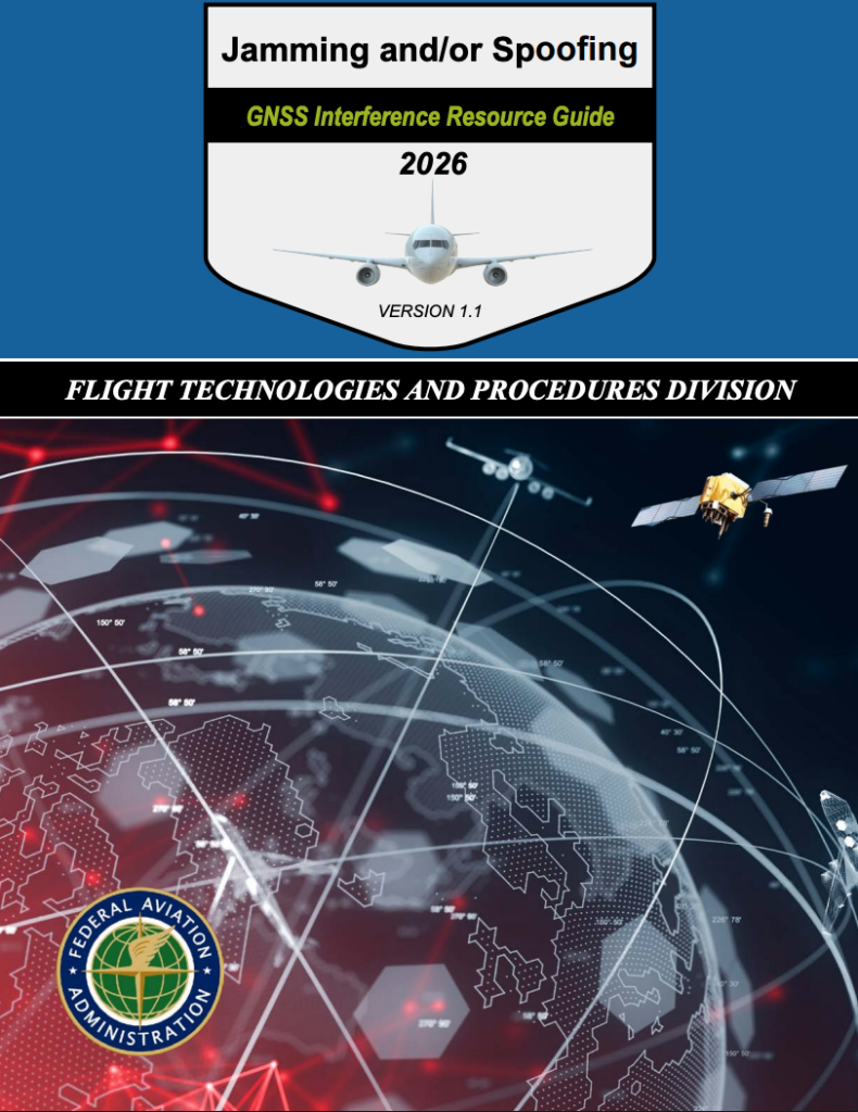
Jamming and/or Spoofing: GNSS Interference Resource Guide
Newly released edition of the FAA’s Global Navigation Satellite System (GNSS) Interference Guide. This significant update offers expanded insight into current jamming and spoofing activity, operational impacts on aircraft systems,…

Report: Indianapolis Downtown Heliport 2024 Assessment Shows Why 8A4 Must Remain Open
Indianapolis has a piece of aviation infrastructure that most cities only wish they had, and aviation consultant Five-Alpha, LLC’s Airport Assessment Report, published June 6, 2024, makes that clear in plain…

The 2025 AAM National Strategy & Comprehensive Plan – A White Paper
This white paper unpacks the U.S. AAM National Strategy and Comprehensive Plan for 2026–2036, detailing how DOT, FAA, NASA, DOD, DHS, DOE, and more than 25 federal agencies will coordinate…
Latest Podcasts

AGN Live! Space Foundation Space Symposium 2026
Autonomy Global Network is heading to Colorado Springs for a special AGN LIVE! stream from Space Symposium. Join host Dawn Zoldi in conversation with leaders from Carahsoft, Lockheed Martin, Epsilon3,…

Manoel Coelho & Samuel Salomao, Speedbird Aero | Dawn of Autonomy | Episode 116
On this week’s episode of Dawn of Autonomy, our “UTM and Infrastructure” month—sponsored by Airspace Link—turns to the front lines of drone logistics with guests Manoel Coelho, CEO of Speedbird…

Full Crew Episode Special Edition: Drone Incursions!
In this special Crew, Colonel Dawn Zoldi (USAF Ret) hosts Maj Gen James Poss (USAF Ret), Brig Gen Houston Cantwell (USAF Ret) and Lt Col Michael Twining (USAF Ret, DroneShield)…