


Sun Tzu told commanders to know the ground and know the weather, and victory would be total. Modern militaries still study his doctrine, yet weather intelligence rarely gets the resources or attention given to sensors, munitions or communications. This gap will decide who gains a critical asymmetric advantage in the drone fights of the next decade, and calls for a transformation in weather doctrine.
I spent 24 years in the Air Force, retired as a Colonel, ran an Air Force base, built regional weather centers and later served as Science and Technology Director at the National Weather Service. I founded TruWeather in 2015 to close the “low-altitude data desert,” the band of atmosphere below 5,000 feet where satellites lose resolution and militaries and homeland defenders have an incomplete view of the weather at the precision and certainty that matters a great deal to successful drone warfare and counterdrone operations. That gap used to matter less because a human pilot sat in the cockpit and adjusted on the fly. Strip the pilot out of the aircraft and the atmosphere becomes the least understood part of the battlespace.
Why Weather Decided D-Day
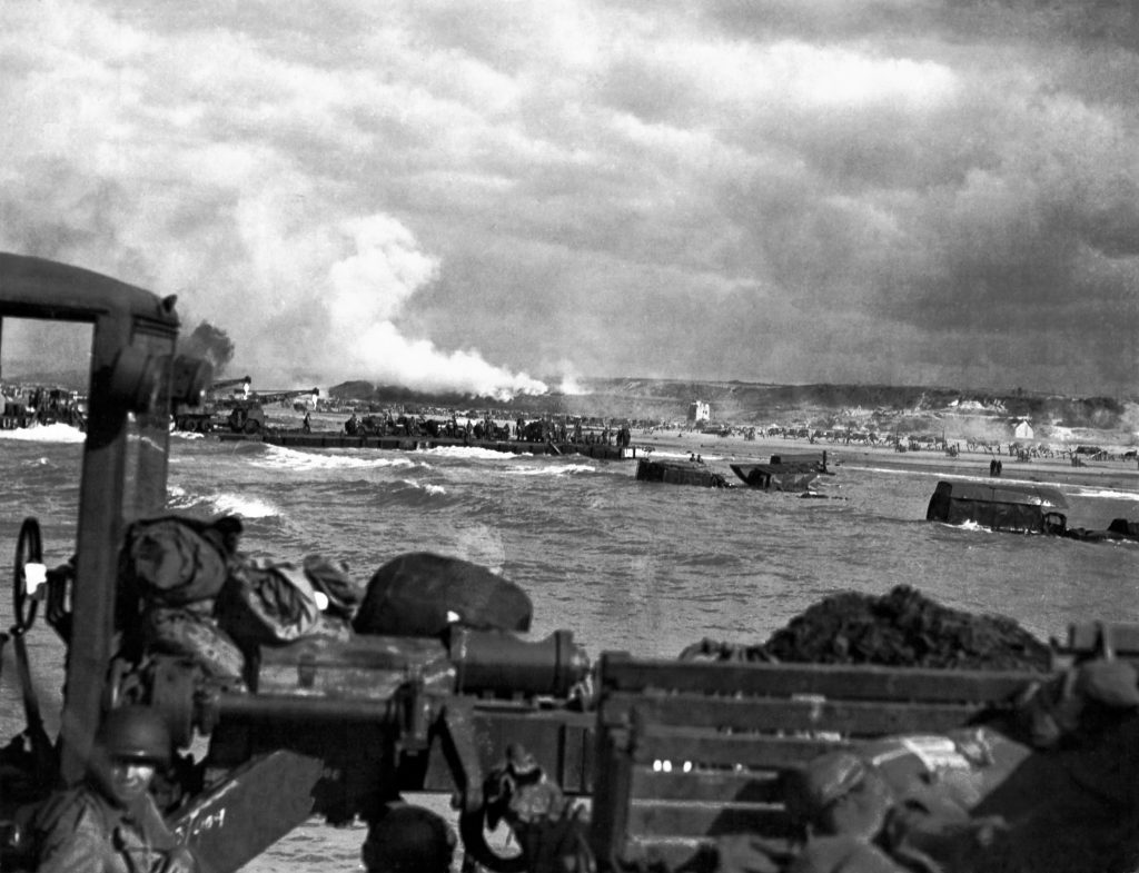
Operation Overlord provides the clearest historical proof that weather intelligence wins battles and can change the outcome of wars. Allied meteorologists read a narrow break in a storm system that German forecasters missed, and Eisenhower launched the invasion in that window. Decades later, when John F. Kennedy asked Eisenhower what made D-Day succeed, Eisenhower said we had better Meteorologists than the Germans. This is a historical demonstration of “weather superiority.” The side with better atmospheric knowledge acted with data-driven insights while the other side guessed.
That lesson translates directly to today’s drone fight. A pilot flying a crewed aircraft could see a wall of fog forming or feel turbulence building and adjust the mission in real time. The human pilot acts as the “best weather sensor” the military has ever fielded, not just because of instruments, but because a person on board could recognize when conditions were about to turn and get out before the problem became an emergency. Remove that person and hand the mission to a drone flying on programmed logic, and the aircraft has no equivalent judgment unless someone builds it in through data. This is a weather precision, certainty and update-cycle problem, not just a weather model coverage or resolution problem.
The Data Desert Below 5,000 Feet
Satellites do excellent work above 5,000 feet, tracking hurricanes days out and mapping weather systems across continents. Below that altitude, where small drones and counter-UAS systems actually operate, weather satellites lose the ability to resolve conditions, route by route, neighborhood by neighborhood, or block by block, and a subset of satellites that may resolve some conditions, have poor refresh cycles.
Government balloon launches happen twice a day from roughly 92 sites nationwide. Airport weather stations report conditions accurate at their exact location and can be unreliable a short distance away on weather impactful days. Those are in the United States, and imperfect even for homeland operations. Few balloons are launched over the oceans and measure the lowest 5,000 feet of the atmosphere. None of them can describe what is happening over a forward operating base, along a drone’s flight corridor, or at a counter-UAS radar site positioned to intercept an incoming threat. And while efforts are underway to deploy weather drones and 3rd party weather balloon launches to fill the gap, these efforts will still be insufficient to achieve the levels of weather certainty needed at all levels of warfare.
I call the resulting operational cost the Weather Tax, the price a force pays when uncertainty forces a cancelled mission, a diverted asset or a conservative decision that turns out to be unnecessary, or when an operator decides to accept the risk, then loses a high demand, low density asset or perhaps survives the flight, but cannot “see” the target. Commercial operators today see a 30% or greater weather-related attrition rate on some low-altitude missions. In a military or homeland-defense context, that same uncertainty either grounds friendly drones that could have flown successfully or causes them to fail to achieve the objective, it degrades counterdrone system effectiveness or, just as dangerously, gives a defending force false confidence that conditions will keep an adversary’s drones out of the sky when they will not.
From Forecast to Firing Decision
The military and homeland security systems have made progress toward integrating weather into the kill and/or interdiction chain. The problem is the weather data feeding these systems has flaws that no amount of AI or ML modeling can solve without better, high density weather data. TruWeather addresses these flaws by introducing capabilities for greater weather data collection in the battlespace through novel data collection techniques, fusion and intelligent delivery approaches. In counter-UAS operations, atmospheric conditions shape nearly every stage of the the mission: where an adversary is likely to stage a launch, how wind and turbulence can bend a small aircraft’s flight path, whether a sensor operator can trust a radar or optical tracking system, and whether an interceptor will perform as expected at the moment it is needed. A gust front never captured can be the difference between a clean intercept and a missed one.
Defending force with better low-altitude data can anticipate how counterdrone systems will perform and an adversary’s drone might perform, when an adversary launch window will open and which sensor type and placement will perform best given the terrain and conditions on hand. That is a fundamentally different posture than reacting to a track once it appears on a screen. Weather superiority, in my assessment, means understanding the environment well enough to shape the fight before the adversary’s system is airborne.
The same logic applies in reverse for friendly drone operations. A strike or reconnaissance drone flying beyond visual line of sight depends entirely on data describing conditions weather systems and the operator cannot see. Wind shear near a ridge line, icing at a particular altitude or a fog bank rolling toward a recovery site are the kinds of hazards a pilot would have caught by eye. A drone flying on autopilot needs that same judgment built into its mission planning software well before launch, not discovered mid-flight.
Building the Digital Backfill
TruWeather’s answer is what I describe as “digital backfill”: replacing the judgment a pilot once carried in their head with sensor networks, fused data and predictive modeling precise enough to support a go or no-go decision at the scale of a single launch site or flight corridor. My company’s V360 platform pulls together ground sensors, wind profilers, aircraft-derived observations and hyperlocal forecasting into a single operating picture, then layers in decision tools that translate raw atmospheric data into a specific recommendation for a specific mission. V360 can integrate all other available weather data, including squeezing out the best satellites can provide, or even other 3rd Party weather systems being leveraged today or tomorrow.
This is a deliberate departure from how militaries accept weather’s uncertainty today as simply “the price of doing business” and coping with what comes at them. I believe Sun Tzu is probably turning in his grave. TruWeather’s model instead treats weather as a live input tied to a specific route, altitude and time. A mission that looks flyable on a regional forecast may still never reach its target, or “see” it target, because weather effects that were not “visible” in the digital systems were unaccounted for. A force that does not have the best weather picture cannot gain weather superiority and are more susceptible to losing an asset or experiencing a missed engagement.
Anticipation matters as much as detection in this model. TruWeather’s doctrine calls for identifying degraded conditions early enough to stage an alternate aircraft, shift a sensor or reposition a team before capability is lost, rather than reacting once a mission is already compromised. The real payoff of better data is not simply guessing whether the weather is good or bad, but knowing what is happening digitally, now and in the future with greater certainty before making the next move.
An Asymmetric Advantage, Not a Convenience
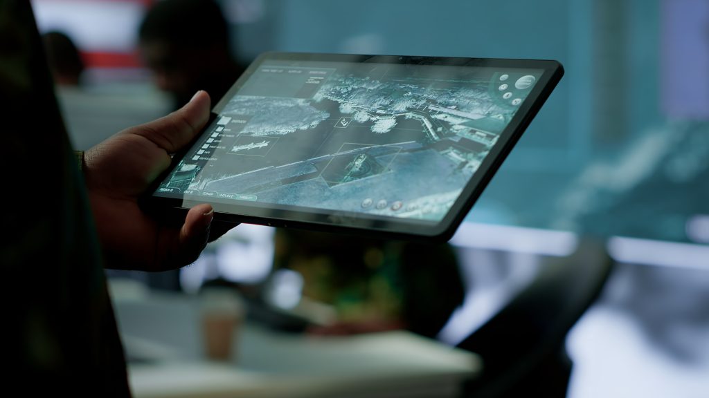
Weather superiority will function the way air superiority or electronic warfare superiority already function, as a force multiplier that changes outcomes across every domain of the fight. A force that understands the low-altitude environment better than its adversary can fly more successful missions, keep drones in the air longer, place sensors where they will actually perform and make counter-UAS decisions with real confidence instead of a guess dressed up as a forecast. It also can serve as an element of surprise, as Eisenhower was fortunate enough to leverage during D-Day. That element of surprise may have saved thousands of Allied lives. A force without that understanding will either overreact to phantom risk and lose the initiative it did not need to lose, or underreact to a real hazard and lose an aircraft, a track or an opportunity to intercept.
As drones and autonomous systems take on more of the missions once flown by humans, the side that invests in the digital infrastructure to replace the loss of a pilot’s senses and onboard judgement will hold the advantage, The side that treats weather as an afterthought will keep paying a tax, in terms of lives and lost opportunity to dominate over an adversary. Those with the better digital infrastructure and a deeper understanding of the environment will gain an asymmetric edge in drone warfare and homeland counterdrone operations. That edge compounds every time a mission launches into airspace that the other side never fully understood in the first place.