

Real-time video and rapid file transfer have changed how government agencies and private asset owners monitor bridges, power grids, water systems and transportation corridors across the country. LiveU, a leader in bonded IP video transmission, provides infrastructure operators a live window into remote assets that once required costly site visits or dangerous manual inspections. Here’s how.
Big Data, Limited Visibility
Infrastructure operators often invest heavily in sensors, mapping tools and control systems. Yet a persistent bottleneck remains: moving massive datasets and video out of remote or low connectivity areas and into the hands of decision makers.

Paul Wheeler of Rawlins Infra Consult, an advisor to transportation agencies nationwide, described the scale of the challenge agencies face. He noted that agencies generate unprecedented volumes of UAS imagery, LiDAR data and incident documentation, but many still struggle to move that information into structured workflows that leadership can actually use for decisions. Wheeler pointed to America’s bridge network as one example. The country maintains more than 617,000 bridges, 42 percent of which exceed 50 years of age, with roughly 46,000 classified as structurally deficient.
Traditional bridge inspection methods rely heavily on inspectors physically climbing structures, rigging ropes and harnesses or deploying snooper trucks to examine hard to reach spans up close. These approaches require lane closures that snarl traffic, expose crews to fall hazards and often force agencies to bring in specialized equipment that sits idle much of the year. A single bridge inspection can take days to complete and generate only a fraction of the data modern operators need, since inspectors capture limited photos and handwritten notes rather than continuous, high resolution imagery. Agencies with thousands of aging structures to monitor simply cannot inspect every asset often enough using these labor intensive methods, which leaves dangerous gaps between scheduled checks where deterioration can go unnoticed.
Ironically, modern inspection methods with drones create their own gaps despite solving the access problem. Drone pilots can capture hundreds of high resolution images and detailed LiDAR scans of a single span in a fraction of the time traditional methods require. But that data often sits on a memory card until the crew drives back to an office with reliable connectivity. Engineers reviewing bridge conditions may wait hours or even days after a flight before they see a single frame, which defeats much of the purpose of collecting real time visual intelligence in the first place. That lag matters most when an inspection uncovers a crack, a corroded support or another urgent defect, since decision makers cannot act on a problem they have not yet seen. Agencies end up trading one bottleneck for another, swapping slow physical access for slow data delivery, unless they pair drone collection with a system built to move that information instantly. LiveU addresses this problem by turning existing cameras, drones and vehicles into a unified real time visual intelligence layer that feeds directly into the systems that asset stakeholders already use, including GIS, SCADA, EMS and video management platforms.
Bonded Connectivity Built For Harsh Conditions
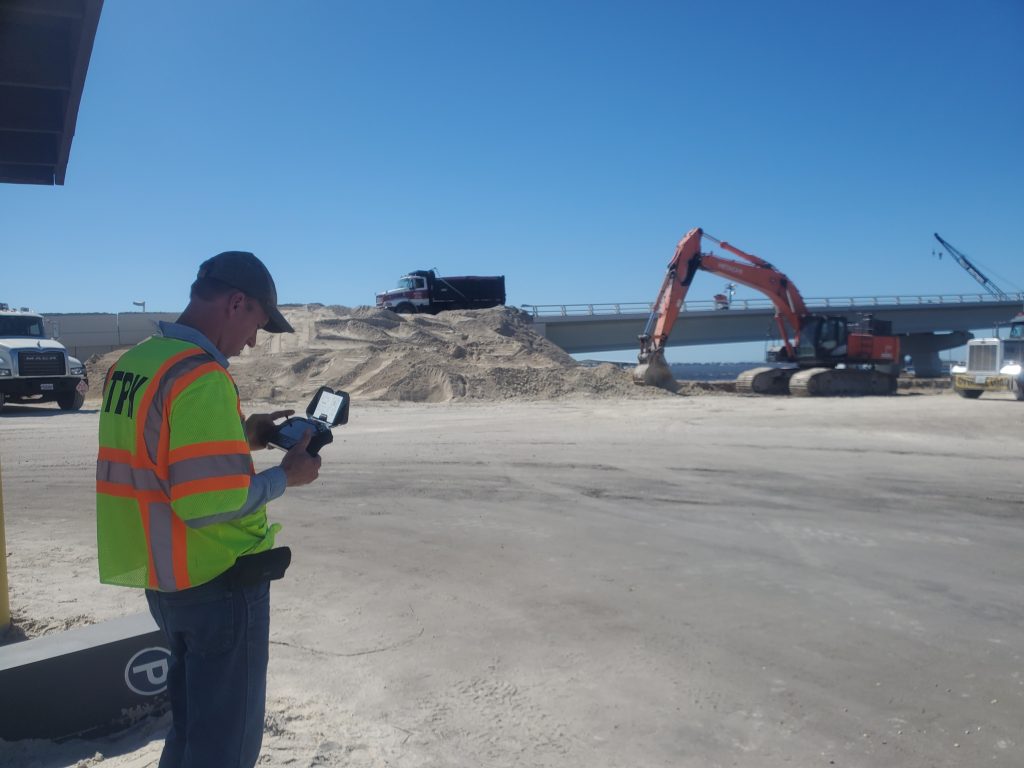
LiveU Reliable Transport (LRT), a patented IP bonding technology engineers designed to keep video and data flowing even inside substations, tunnels, bridges, plants and long transportation corridors, provides the core of LiveU’s approach. Rather than depending on a single cellular or IP connection that can drop or congest, LRT combines up to 14 connections such as cellular, WiFi and satellite services like Starlink into one resilient data pipe. If one network degrades, the system automatically shifts the load to another available connection, so the stream stays intact.
LiveU field encoders extend this reliability to nearly any environment. Crews deploy them as portable units, fixed installations or vehicle mounted systems. They can connect to almost any video or data source through HDMI, SDI, IP or USB. This flexibility gives inspection teams continuous visibility into asset conditions, whether they stand at a remote pump station or ride along a rail corridor.
Accelerating File Transfer From Field To Command
Large inspection files do agencies little good sitting on an SD card in a truck. LiveU FileBridge solves that problem by using bonded connectivity to upload video, photos and mapping datasets at speeds up to 250 Mbps directly from the field into headquarters systems.

During one demonstration at the International Highway Engineering Exchange Program, upload speeds reached up to 1GB per minute. This provides a clear advantage for agencies managing 100GB drone datasets. Such performance eliminates the need to drive back to base to offload data and shortens the time between capture and actionable insight.
In another example, the California Department of Transportation partnered with Skydio, Trimble, ESRI, the San Diego Association of Governments and the City of San Diego to test UAS driven construction inspections. LiveU helped to power that grant-funded study. LiveU’s IP Pipe feature enabled remote experts to control PTZ cameras during bridge or pavement inspections without deploying additional staff to the site. Video Return as a Service added two-way live collaboration between field crews and command centers, so engineers back at headquarters could see exactly what inspectors saw in real time. In the end, the study showed that drone technology, powered by LiveU, saved time and money, produced better data for administering construction contracts and reduced worker injury claims compared to traditional inspection methods.
It’s no wonder LiveU has been described as “the Swiss Army knife of transportation and infrastructure management.” It simply connects disparate platforms without replacing any of them.
Incident Management Gains New Reach
For critical infrastructure owners and operators, when calamity strikes, LiveU can also extend bonded video into the air from drones to stream aerial footage that helps commanders assess accident scenes, roadway damage or environmental threats before crews arrive on scene.
For example, drones can carry thermal cameras that identify overheating electrical components on transit lines or locate victims during search and rescue operations, then transmit that imagery over the same bonded network. Using LiveU, incident commanders can reliably evaluate a multi-vehicle pileup, a wildfire encroaching on a highway or structural damage after a storm long before responders physically reach the location.
This architecture supports a variety of workflows, including “drone-as-first-responder” (DFR), increasingly deployed in the critical infrastructure sector, where drones equipped with live video transmitters deliver high definition footage to command centers within seconds of dispatch. (See prior AG coverage of DFR for the energy sector). That head start narrows the gap between detection and decision to give leaders the situational intelligence they need to coordinate detours, manage incidents and deploy resources more effectively.
What This Means For Critical Infrastructure Nationwide
State transportation and utility agencies increasingly view live video as an operational necessity. Agencies have shown a strong willingness to collaborate, since everyone tackles similar infrastructure challenges at different stages of technology adoption. The Departments of Transportation in Florida, Alaska and Alabama already use this technology to gain a live operational picture across massive networks and improve coordination between agencies.
The following comparison highlights how LiveU’s core capabilities map to specific infrastructure needs.
| Capability | Function | Primary Benefit |
| LRT bonded transport | Combines up to 14 network connections into one pipe. | Keeps video live even in low signal areas. |
| FileBridge file transfer | Moves large datasets at speeds up to 250 Mbps. | Eliminates the drive back to base to offload data. |
| IP Pipe | Enables remote PTZ camera control. | Reduces need for extra staff on site. |
| VRaaS | Provides two way live video collaboration. | Connects field crews directly with command centers. |
| Drone integration | Streams aerial footage in real time. | Speeds DFR deployments. |
This convergence of bonded connectivity, rapid file transfer and drone integration can significantly change how the nation protects its bridges, power grids and transportation corridors. As infrastructure keeps aging and data volumes keep climbing, the agencies that can close the gap between field capture and command center insights will hold a clear operational advantage over those that simply continue to rely on manual inspections and disconnected systems. LiveU can help bridge that gap.