The Space Symposium 2025 in Colorado Springs brought together some of the brightest minds and leading organizations in the space industry who showcased cutting-edge advancements that are shaping the future of space exploration and security. Carahsoft, The Trusted IT Solutions Provider, made its debut at the event and several of its partners stood out as space tech leaders: L3Harris, a key player in national security, whose latest initiatives are setting new benchmarks for space defense; Spire Global, enabling early wildfire detection and democratizing satellite access; and Slingshot Aerospace’s AI-powered satellite surveillance capabilities. Here are their latest updates.
Spire Global Reveals Space Reconnaissance and Environmental Solutions
Spire Global unveiled a suite of advancements that reinforce its reputation as a leader in space-based data, environmental monitoring and sovereign space solutions. Under the guidance of Iain Goodridge, Director of Space Reconnaissance, Spire continues to expand the boundaries of what small satellites can achieve for governments, commercial partners, and society at large.
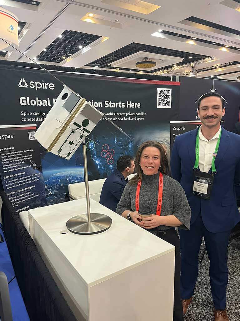
Space Reconnaissance: A New Business Unit for a Changing World
At this year’s symposium, Spire introduced its Space Reconnaissance business unit. Developed in response to shifting global demands for secure and independent data, this unit leverages Spire’s expertise in radio frequency (RF) detection, geolocation and exploitation.
Goodridge explained, “We detected a real shift in the market, especially globally, as the reliance on sharing information with certain governments around the world is changing. We picked up on that need and started to invest in that.”
Spire’s Space Reconnaissance is already delivering for customers, with several successful demonstrations at the show. The unit’s capabilities are attracting interest from countries seeking to build their own sovereign space networks, consistent with a broader trend toward national self-reliance in space-based intelligence and situational awareness.
Canadian Wildfire Detection Contract: Protecting Lives and Land
Spire also announced its pivotal role in a large-scale Canadian wildfire detection initiative. The company is building a new set of satellites equipped with advanced payloads designed for early wildfire detection and hotspot monitoring. This contract is not only significant for Spire’s growth, according to Goodridge, but also demonstrates how space-based data can directly benefit society. He noted, “It plays in very well to Spire’s core focus about improving things on Earth using our satellites.”
This technology goes beyond traditional imagery. It operates in specialized frequency bands to detect flare-ups and hotspots in real time. This capability is critical for early intervention to potentially save lives and minimize environmental damage. The wildfire detection project builds on Spire’s established track record in providing weather and climate data to organizations like NOAA and AWS and further cements its role as a trusted partner in environmental monitoring.
Space Services: Democratizing Access to Space
Goodridge also highlighted Spire’s Space Services offering at the symposium. This service allows organizations to deploy their own payloads on Spire’s proven satellite platform—nicknamed “LEMURs” (Low Earth Orbit Multi Use Receivers)—without the need to become a space company themselves.
“There are a shocking number of companies that have a fantastic idea about a space payload…but they don’t want to become a space company. That puts us front and center,” Goodridge explained.
This approach lowers barriers to entry for innovation in space, enabling research institutions, startups, and even governments to rapidly test and deploy new technologies. By maturing its value chain and offering satellites as a service, Spire is helping to democratize access to space and accelerate the pace of discovery.
Why It Matters: At Space Symposium 2025, Spire demonstrated why it is at the forefront of the new space economy. From pioneering RF geolocation for national security to enabling early wildfire detection and democratizing satellite access, Spire’s innovations appear to be shaping a safer, more informed and more connected world
What’s Next: Spire anticipates continued growth in its Space Reconnaissance business, with governments worldwide seeking to build out their own space-based networks. The company is also expanding its manufacturing footprint, with satellite production facilities in Glasgow and new sites coming online. As more countries prioritize sovereign space capabilities, Spire will remain positioned to provide turnkey solutions for national security, environmental monitoring and commercial innovation.
How to Learn More: For those interested in Spire’s latest initiatives, the company encourages outreach via LinkedIn and its website, spire.com, where detailed information about its services and technologies is available.
Slingshot Aerospace: AI-Powered Surveillance for Space Security
At Space Symposium 2025, Slingshot Aerospace captured attention with its groundbreaking advancements in space domain awareness by securing a pivotal role in the U.S. Air Force’s RAPTOR (Rapid Analysis of Photometric Tracks for space Object identification and behavior Recognition) program. This initiative leverages machine learning to detect and analyze suspicious satellite activities in low Earth orbit (LEO) and addreses growing concerns over adversarial space operations.
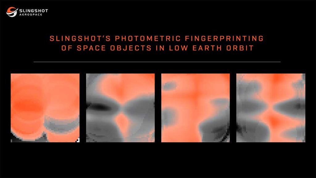
Digital Fingerprints and Anomaly Detection
Under RAPTOR, Slingshot will use its Global Sensor Network—a constellation of optical sensors generating over 4.5 million nightly observations—to create unique digital “fingerprints” for space objects. These fingerprints, derived from photometric data (light curves), enable precise identification of satellites and debris. The system’s Agatha AI model analyzes these signatures to detect anomalies like unexpected maneuvers, orientation shifts or mission changes.
“Establishing a comprehensive fingerprint database allows us to infer an object’s nature and mission objectives,” said Dr. Dylan Kesler, Slingshot’s VP of Data Science.
The technology is already operational in support of U.S. Space Command in maintaining custody of high-priority assets and reacquiring lost tracks during orbital intermingling or obfuscation attempts.
Why It Matters: RAPTOR addresses critical gaps in space situational awareness to counter covert threats by:
- Tracking nefarious activities: It alerts defense agencies to satellite behavior that may signal imminent threats, such as adversarial maneuvers near critical infrastructure.
- Swiftly reacquiring custody: It rapidly identifies objects even after deliberate attempts to disguise their orbits.
- Monitoring Multi-Global Navigation Satellite Systems (GNSS): It expands beyond GPS to detect jamming/spoofing across global navigation systems (e.g., Galileo). This enhances resilience for military and civilian users alike.
The program’s AI-driven insights are ever-more vital as conflicts extend into space. Tim Solms, Slingshot CEO, emphasized, “Comprehensive visibility is non-negotiable for safeguarding national interests and allied security.”
What’s Next: Slingshot plans to scale its defense capabilities by integrating pattern-of-life algorithms to predict adversarial behavior and enhance its user interface for seamless integration with warfighter systems. The company is also advancing its PNT-SENTINEL initiative under a separate $1.9 million Space Force contract, which uses satellite data to geolocate GPS jamming sources, a capability already deployed in active conflict zones. With RAPTOR and PNT-SENTINEL, Slingshot is fast becoming a linchpin in global space security.
How to Learn More: Visit slingshot.space and follow Slingshot Aerospace on X and LinkedIn for the latest information.

L3Harris Leads the Charge in Space Defense…and Beyond
L3Harris Technologies unveiled several groundbreaking advancements across space control, missile defense and environmental monitoring. In an interview at the symposium, Mukul Dixit, Director of Mission Strategic Integration for L3Harris, emphasized the importance of maintaining space superiority in a contested domain. Here is what the company is doing about that.
Golden Dome and Space Control: A New Era of Superiority
As space becomes increasingly congested and contested, L3Harris is leveraging its expertise to develop technologies that enhance situational awareness, enable rapid maneuverability and ensure mission success in the face of emerging threats.The president’s executive order known as the Golden Dome initiative represents a significant leap forward in ensuring secure and resilient operations in orbit.
The Golden Dome approach to missile defense includes systems designed to track hypersonic threats with precision, overcoming limitations in traditional missile defense architectures. With the space vehicle and infrared sensor for MDA’s Hypersonic and Ballistic Tracking Space Sensor (HBTSS) ready for full-rate production, L3Harris stands poised to deliver global coverage for missile tracking under this ambitious initiative.
Dixit highlighted the company’s work on these key Golden Dome technologies and how it aligns with recent presidential directives to bolster national security. “Space is not free anymore,” he said. “There’s a need for us to maneuver and maintain our space superiority. Innovations like HBTSS are critical to maintain strategic advantages as nations and private entities vie for dominance in this vital domain.”
FOO Fighter Program: Further Strengthening Missile Defense
Also related to national defense, L3Harris announced two other key milestones for SDA’s Fire-control On Orbit-support-to-the-war Fighter (FOO Fighter) program: the delta Critical Design Review (dCDR) and Production Readiness Review (PRR). These steps pave the way for delivering eight infrared payloads capable of high-fidelity tracking of hypersonic missiles. This program, designed to provide advanced capability as part of SDA’s Proliferated Warfighter Space Architecture (PWSA) initiative, offers scalable solutions at reduced costs compared to legacy systems.
Meadowlands: Enhancing Offensive Counterspace Capabilities
L3Harris attained another major milestone – this one for its Meadowlands program. It completed the System Verification Review (SVR) for the U.S. Space Force’s Counter Communications System (CCS). This mobile satellite jammer upgrade enhances operational flexibility with expanded frequency ranges and remote command capabilities. Meadowlands is a critical tool for countering adversarial satellite threats.
GOES-19: Revolutionizing Weather Monitoring
NOAA’s GOES-19 weather satellite, equipped with L3Harris’ Advanced Baseline Imager (ABI), was declared fully operational as “GOES East.” This cutting-edge technology provides real-time data to track severe weather events like hurricanes and wildfires across the Western Hemisphere. As part of NOAA’s GOES-R Series, GOES-19 plays a vital role in disaster preparedness and environmental monitoring.
MOSSAIC Program: Advancing Space Domain Awareness
Under its Maintenance of Space Situational Awareness Integrated Capabilities (MOSSAIC) contract with the U.S. Space Force, L3Harris continues to modernize ground systems that detect and track deep space objects. These upgrades enhance situational awareness in contested environments to ensure timely responses to space-based threats.
Why It Matters: These advancements underscore L3Harris’ commitment to address critical challenges in national security and environmental resilience:
- Space Control: Meadowlands ensures U.S. forces can counter adversarial satellite threats.
- Missile Defense: Advanced on-orbit technologies being developed to protect against hypersonic weapons.
- Environmental Monitoring: GOES-19 improves disaster preparedness through real-time data.
- Space Domain Awareness: MOSSAIC upgrades provide accurate tracking of space debris and satellites.
What’s Next: Dixit also highlighted a growing trend at this year’s symposium: integrating commercial technologies into national security frameworks. “There’s a lot of new companies whose names I haven’t heard yet, but they’re doing really cool things,” he said. It should come as no surprise, then, looking ahead, that L3Harris is scaling production for key programs. The company has invested $200 million into infrastructure upgrades in Fort Wayne, Indiana, and Palm Bay, Florida, to support future manufacturing needs for its defense customers.
How to Learn More: For those eager to follow L3Harris’ groundbreaking work in space control and national security, the company maintains an active presence on social media platforms like Instagram, Twitter, and YouTube. Additionally, their official website (L3Harris.com) offers detailed insights into ongoing projects and strategic initiatives.
Carahsoft: Your Trusted Government Partner for Space Tech
At the 40th Space Symposium, Carahsoft stood out as a driving force behind the public sector’s rapid adoption of these cutting-edge space technologies from organizations like L3Harris, Spire Global and Slingshot Aerospace. Represented by Senior Account Manager Matt Manning, Carahsoft underscored its expanding commitment to the space sector and its pivotal role as a government IT solutions aggregator.

Expanding Into Space: Carahsoft’s Mission and Momentum
Carahsoft has long been recognized for connecting government agencies with leading technology providers, but its recent push into the space sector marks a significant evolution.
“We’ve been trying to expand out into the space vertical,” Manning shared during the symposium. “This is our first time here at the Space Symposium. We are excited to see all the vendors here in the space sector and build on our legacy of geospatial expertise.”
Carahsoft designed its Space Tech portfolio to meet the unique demands of government agencies involved in space flight, communications, exploration and earth observation. The company and its partners deliver end-to-end solutions, including Global Positioning Systems (GPS), orbital satellite tools, geospatial analytics and advanced software and hardware for mission-critical operations. These technologies support a wide range of applications, from disaster management and public safety to national security, agriculture and environmental monitoring.
Manning expressed enthusiasm for the space sector’s energy and innovation. “We’re excited to be part of this growing community and to help agencies and partners achieve their missions.”
Why It Matters: The importance of Carahsoft’s efforts lies in its ability to streamline access to innovative space technologies for the public sector and enable mission success. By aggregating best-in-class solutions from a vast network of vendor partners, Carahsoft empowers agencies to:
- Enhance situational awareness and intelligence operations with real-time satellite data
- Improve disaster response and climate resilience through advanced earth observation tools
- Support secure and efficient communications for defense, intelligence, and civilian missions
- Leverage geospatial products and services for smarter decision-making across government, healthcare, transportation, and more
Carahsoft’s presence at the Space Symposium also reflects the growing intersection between geospatial technology and space innovation, as agencies seek to harness trillions of data points for everything from collision avoidance to environmental stewardship.
What’s Next: As Carahsoft plans to continue to expand its space line of effort. It remains dedicated to bridging the gap between technology innovators and the public sector, ensuring that agencies have the tools they need to succeed in an increasingly complex and data-driven space environment.
How to Learn More: For technology vendors, resellers, and solution integrators eager to enter or expand within the public sector space market, Carahsoft offers a partnership model proven to accelerate innovation together. As the Master Government Aggregator®, Carahsoft provides its partners with access to an extensive ecosystem, robust contract vehicles, and expert sales and marketing support. Partners benefit from Carahsoft’s experience in navigating the complexities of government procurement and its established relationships across federal, state, and local agencies.
Visit Carahsoft’s partner portal or contact their team at partners@carahsoft.com to start the conversation. Fill out the online information form to join Carahsoft’s partner ecosystem and accelerate your organization’s public sector growth on Carahsoft.com.Watch the Full Crew from the 40th Space Symposium, sponsored by Carahsoft and featuring Carahsoft and L3Harris, among others, here.
By: Dawn Zoldi

