

In New Zealand, Kaingaroa Tipu (KT) has turned a century‑old forest into a testbed for intelligent, sustainable operations, using LiDAR, UAVs, satellite imagery and geoAI to manage every tree like an asset in a live digital twin. For autonomy and unmanned systems professionals, KT’s Esri User Conference story provides a blueprint for data‑driven, semi‑autonomous infrastructure at landscape scale.
From Paper Maps To GeoAI Brain Trust
Three geospatial leaders who bridge research, operations and systems design drive The Enhanced Forest Description story at KT: Lead Geospatial Analyst (Intelligence) Cheryl Hindle, Geospatial Manager Lorin Lima and Lead Geospatial Analyst (Systems) Lan Nguyen. Together, they have turned what was once a traditional mapping function into a geospatial “brain trust” that touches every part of KT’s business, from genetics and silviculture (the branch of forestry focused on how to grow and manage a forest over its entire life cycle) to safety and sustainability.

Hindle has been with KT for 18 years and has seen that transformation from the ground up. She started using ArcMap in the mid‑1990s, digitizing large paper topographic maps, then built experience across consultancy, seabed mapping in the fishing industry and now nearly two decades in forestry. She has watched KT evolve “from a company that just made maps of where we plant trees, where we harvest trees into using a lot of technology to help all our operations and our senior leaders and help us make decisions, whether it be about genetics or environmental or legal issues.” That long view gives her a deep sense of how far the organization has come and what it will take to keep pushing forward.
Lima brings crisis‑management and national‑scale experience, including COVID‑19 response mapping that featured in former New Zealand Prime Minister Jacinda Ardern’s public briefings. She sees KT’s Enhanced Forest Description as “pushing the boundary of an intelligent forestry system and understanding of what the digital twin of the forest looks like at any given point,” built from satellite capture, LiDAR and analytical models.
Systems‑focused Nguyen designs and maintains the geospatial backbone that turns research outputs into operational tools. With roughly 20 years of experience in natural resources management and modeling, he looks after the systems, “designing and making things work, enabling things and trying to explore more interesting technology to get into the day‑to‑day workflow,” so every investment in data and software returns tangible value across the business.
The Enhanced Forest Description did not emerge overnight. The initiative grew from years of research and experimentation undertaken by Kaingaroa Tipu’s Research and Development Team, who explored how LiDAR, high-resolution imagery, machine learning and satellite data could augment traditional forestry measurements. Having proven the underlying science, the challenge shifted from research to scale: transforming promising analytical workflows into enterprise systems, operational processes and decision-support tools used across the business today.
A City‑Scale Forest With Its Own Infrastructure
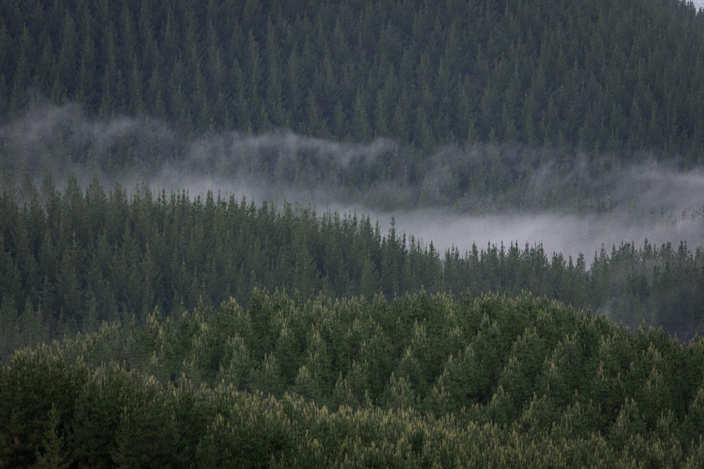
KT manages about 235,000 hectares of contiguous forest in New Zealand’s central North Island, roughly 580,000 acres stretching 100 kilometers north–south and 50 kilometers across. Lima likens it to “the size of a large city,” complete with internal road networks, bridges, electrical lines and on‑site processing facilities that KT maintains itself.
The landscape consists of a high‑altitude plateau between 500 and 1,000 meters, considered relatively easy by New Zealand forestry standards but dissected by steep, erodible gullies carved into volcanic soils. Hindle noted that the terrain still poses significant risk whenever people manually fell or load trees, which drives KT’s push toward mechanization and automation for safety.
KT’s estate originated in early‑1900s experiments with exotic species when the country realized native timber stocks were unsustainable. Radiata pine from California’s Monterey Peninsula was eventually selected as the primary crop, and in the late 2000s the land was returned to Māori indigenous owners under treaty settlements. KT leases and manages the forest in partnership with those iwi landowners.
Enhanced Forest Description: A Unified Key For Every Tree
KT’s Enhanced Forest Description project sits at the core of its intelligent forest strategy. The team uses satellite capture, LiDAR, UAV‑borne RGB imagery and analytical models to maintain an up‑to‑date representation of what the forest looks like today, tomorrow and through its entire life cycle.
Hindle described the pipeline as a marriage of R‑based analytics (referring to R programming language, a specialized environment for statistics, modeling and data visualization) and deep learning. KT derives tree metrics from LiDAR point clouds, including height, crown characteristics and volume, while using deep learning on RGB imagery to detect individual trees, especially young stands that are too small to show up cleanly in LiDAR. Those outputs flow into individual‑tree databases that Lan’s systems compile into surfaces showing stand‑level volume, stocking and other operational metrics.
Lima framed the technology’s return on investment (ROI). What used to take 40 to 100 hours on foot in difficult terrain has been reduced to “a matter of hours or a couple of days of work.” She estimated this slice of the project alone to have saved KT around five million dollars annually. Similar geospatial initiatives have delivered additional multi‑million‑dollar gains across operations.
UAV LiDAR And The Road To BVLOS
Remote sensing has replaced much of the traditional plot‑based, tape‑measure forestry that relied on crews wrapping measuring tapes around trunks and using handheld devices to estimate height. KT now flies LiDAR under drones inside its estate to capture point clouds and imagery before and after thinning to measure structural change and support selective harvesting.
As in other locations globally, the regulatory landscape in New Zealand has not kept pace with the technology or its use cases. The civil aviation authority requires drones to remain within visual line of sight, which sharply limits capture area per flight. “Once we go to BVLOS beyond visual line of sight then we can ramp up production and overwhelm all our systems and services with data,” Hindle said, half jokingly but clearly serious about the throughput challenge.
That transition will demand rigorous aeronautical awareness. KT needs to understand airspace use and deconfliction as thoroughly as it understands road networks and truck routes. Nguyen has already begun work on this, laying foundations that will matter not just for data capture but for future autonomous operations in forest airspace.
Esri, ArcGIS Enterprise And SQL Automation At Scale
KT has committed heavily to the Esri and Microsoft ecosystems, aligning business systems around ArcGIS Enterprise, ArcGIS Online and associated tools instead of investing in bespoke open‑source stacks. Nguyen values Esri’s ability to take an idea from prototype to test phase quickly, with components that “talk to each other” across the geospatial estate.
Survey123, QuickCapture, Field Maps and ArcGIS Experience Builder form the main operational UX layer. KT has deployed roughly 60 Survey123 forms across different departments, from roading crews and cleaning teams to planting contractors, converting paper‑based workflows into live, digital forms. “We used to take at least two days to see the numbers in Excel,” Lan noted, “now it is within minutes. Whenever the guys submit the data, we pick it up and automatically generate the report.”
At the backend, SQL automation ties UAV‑derived metrics, satellite imagery, safety reports and contractor data into a unified schema keyed to the Enhanced Forest Description ID (EFDID). Real‑time services push those insights into ArcGIS Experience Builder dashboards, which give KT’s geospatial team and business leaders instant access to high‑resolution operational data inside ArcGIS Enterprise and ArcGIS Online.
Autonomy, Fleet Electrification, And Safety Intelligence
For a forest that functions like a city, autonomous systems are a logical next step. Lima pointed to major road arteries inside the forest as ideal candidates for autonomous trucking, once KT understands the road lining, loading sites and infrastructure upgrades required.
Driver shortages, rather than cost‑cutting, drive the business need. Younger generations show limited interest in forestry trucking. KT sees autonomy as a way to keep operations sustainable while protecting jobs where they matter most. Electrification, in turn, opens opportunities for fully instrumented fleets where telematics, geospatial data and safety analytics blend into a continuous operational picture.
KT already runs best‑in‑class health and safety processes with a 24‑hour incident reporting requirement and in‑cab video monitoring. Systems detect drooping eyelids or signs of fatigue and push real‑time alerts like “maybe you need to get a coffee” before an accident occurs. Aggregated geospatial and safety data highlight hotspots where road alignments, slope, surfacing, or driver training need attention. All of this allows KT to proactively redesign infrastructure or interventions.
Planting, Genetics And Full Life‑Cycle Traceability
KT plants around 7,000 hectares of forest per year. It owns both a nursery and a genetics laboratory, giving it end‑to‑end control over clonal genetics. Crews deploy seedlings with GPS so the team knows which genetics went where, then drones and LiDAR track growth at stages across the life cycle.
Hindle described a new planting application built with Survey123 to solve a seemingly simple but high‑impact problem. Contractors once used handheld Garmin GPS units to mark genetic boundaries, but sometimes forgot to walk down the line. This led to uncertainty in block‑level genetics mapping. Now, planters walk around their block with a mobile app that pulls genetics options directly from the nursery database and records exactly which clone was planted where.
Lima explained the long‑term payoff. KT can now trace an individual tree from germplasm in the lab through planting, thinning, and harvest, including volume, operations history and environmental context. “If we had a name tag for them, we could say Charlie is this and this is exactly how Charlie was made and where he’s been this entire time,” she said.
Sustainability, Biodiversity And Geo‑Enabled Conservation
KT’s operations are firmly rooted in sustainable forestry rather than native forest clearing, and about 13 percent of the estate is set aside as conservation habitat. Rare and threatened species are thriving in those protected areas, while broader biodiversity across the Radiata crop is higher than many would expect.
Hindle and the geospatial team built a QuickCapture app that mobilizes staff and contractors as citizen-scientists. A motivated sustainability team encourages crews to report rare and pest species. Now KT receives hundreds of observations a year, turning the forest into a kind of private iNaturalist. Kaingaroa is believed to host the largest habitat for New Zealand’s native falcon and a significant population of a rare native orchid, which the KT team discovered by accident.
The company’s sustainability goals extend beyond biodiversity. KT focuses on eliminating fossil fuels from its supply chain, restoring local communities and villages inside the forest, strengthening relationships with iwi landowners and enhancing protection around waterways.
GeoAI, Knowledge Graphs And What Comes Next
AI is still emerging inside KT, but geoAI is not theoretical. The R&D team already uses deep learning and machine learning for change detection and to feed decision‑making structures across operations. Lorin calls herself, Nguyen and Hindle the “brain trust for geoAI” in the organization and stresses the need for a clear strategy on where to take it next.
Nguyen expressed excitement about Esri’s Knowledge Graph, which he sees as a crucial layer between large language models and KT’s real geospatial data. It provides the bridge between generic AI assistance and truly domain‑specific decision support grounded in trusted spatial and temporal datasets.
KT has already implemented Microsoft Copilot internally and watches for tighter integration with Esri’s tools and emerging agentic AI capabilities. The question is not whether KT will use AI, but how quickly it can align AI services with its unified data key, digital twin and existing workflow automation so each new capability translates into measurable operational value.
How To Engage With KT’s Geospatial Vision
KT’s story is more than a forestry case study. It is a model for how large, complex, semi‑autonomous estates can use LiDAR, UAVs, satellite data and geoAI to manage infrastructure, safety and sustainability at city scale. For autonomy, unmanned systems professionals and UAS Traffic Management (UTM) providers, the Enhanced Forest Description and BVLOS ambitions offer a space ripe for collaboration around sensors, autonomy stacks and AI‑ready spatial data models.
Those interested in learning more or exploring partnerships can visit KT’s website at kt.co.nz for background on the forest, its mission and current opportunities. The geospatial team welcomes inquiries at geospatial@kt.co.nz, especially from people who want to work on the future of intelligent forestry and geo‑enabled autonomy.