By: Clint Harper, AG AAM Ambassador
In a request for information (RFI) last year that received only nine responses, the Federal Aviation Administration (FAA) asked the question: what is a droneport? While many answered this question in their responses, the overall vibe resembled a collective shrug. Not because it didn’t matter, but because logistics drones were already flying real-world missions from designated sites. Launch pads were already built. Infrastructure was already wired into parking lots, landfills, and industrial areas. The system was already moving and the regulators were just getting started. Today, the conversation around droneports continues to lag behind these operational truths. The infrastructure already built lacks oversight and standardization. This creates unnecessary risk for the industry and the communities they serve.
Since then, the FAA has published a 731-page proposed rule (Parts 108 and 146) that defines BVLOS operations and certifies supporting service providers. Notably, it does not define or clear up any ambiguity around droneports. Before we get started, to be clear, the point of this article is not to suggest that current operators are acting irresponsibly. On the contrary, many are doing everything they can to manage risk in the absence of clear standards. They are navigating uncertainty with waivers, internal risk mitigation protocols, and local coordination efforts. The problem is not the operators, but the absence of a defined design framework. While the FAA’s attention has remained on vertiports and passenger-carrying aircraft, whose timelines continue to slip, droneports have quietly become the front line of advanced air mobility’s (AAM) ground game. The infrastructure is real. The safety concerns are real. But the system still lacks the policies to deal with them.
Looks Like a Droneport, Acts Like a Droneport, But What Exactly Is a Droneport?
By the time the RFI hit the Federal Register, commercial drone launch and recovery facilities were already operating in cities across the country. According to environmental documents, some were expecting to fly hundreds of sorties a day. Yet, there were no established design standards. No licensing frameworks. And in most cases, no oversight beyond whatever could be justified in environmental reviews and operational waivers. As a result, the RFI attracted a wide range of comments.

Smells Like Overregulation
Some warned that regulation would harm innovation. The FPV Freedom Coalition, for example, raised concerns that any formal designation of droneports could unfairly burden hobbyists and small operators, many of whom rely on open, flexible launch sites to conduct safe and legal flights. To them, requiring droneports to mirror legacy aviation standards felt like regulatory overreach. For example, in its RFI Response, the FPV Freedom Coalition, said, “We believe there is a real risk that ‘droneport’ regulations could evolve into yet another barrier to entry for small UAS operators, particularly those flying under Part 107 or recreational rules.”
Lack of Regulation Creates Risk
Others warned that the absence of standards presents its own kind of risk. These commenters, some with decades of infrastructure experience, cautioned that droneports, especially those supporting beyond visual line of sight (BVLOS) or Part 135 commercial carrier operations, functionally resemble heliports in both safety profile and infrastructure demand. In their view, the longer we delay establishing clear design standards, the more we risk fragmented, reactive policy.
Rex Alexander, Founder of Five-Alpha LLC and world-renowned infrastructure expert, noted in his RFI Response, “Droneports that support advanced or repetitive operations, especially BVLOS or those under Part 135, already resemble heliports in infrastructure and risk… Standardizing siting, markings, lighting, and separation is not about restricting innovation. It is about ensuring that as UAS operations scale, they do so without creating new hazards.” Alexander and others urged the FAA to consider the infrastructure’s role in deconfliction, safety, and airspace transparency; elements that become more critical as scale and autonomy increase.
No One-Size-Fits-All
Still others argued that regulation shouldn’t be based on aircraft category or mission type, but rather on operational tempo, permanence, and public exposure. In other words: a droneport used for 5 landings a week would not need the same scrutiny as one launching 400 flights a day, regardless of whether the aircraft is 12 or 55 pounds .Jonathan Daniels, Formerly of Praxis Aerospace, wrote, “Infrastructure requirements should be scaled by operational tempo, location, and exposure. A site launching 400 flights per day in urban airspace is fundamentally different than a rural farm pad used weekly.”
Flying Without a Framework: The Unseen Infrastructure Behind Drone Delivery
While the FAA’s RFI asked what droneports could or should be, a parallel reality had already been unfolding. Operators were flying missions from fixed locations, some in large volumes, with no clear designation or oversight as aeronautical infrastructure. What continues to be missing is formal recognition of the infrastructure supporting those flights. This can create hazards and increase danger.
Reality Check: They Built It Already
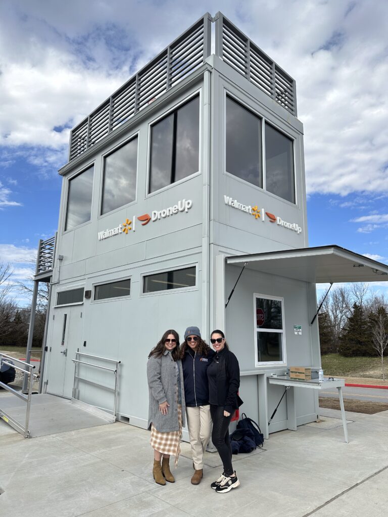
A review of environmental assessments and FAA-authorized Part 135 operations shows a picture far more advanced than most public discourse would suggest. Companies like Amazon, Wing, Zipline, UPS Flight Forward, and DroneUp have been conducting routine drone deliveries across the country. Some sites accommodate up to 500 operations per day. These are not trials. They are active logistics facilities. Some repurposed parking lots or commercial property to support high-tempo flights under FAA-approved waivers and internal risk-mitigation procedures.

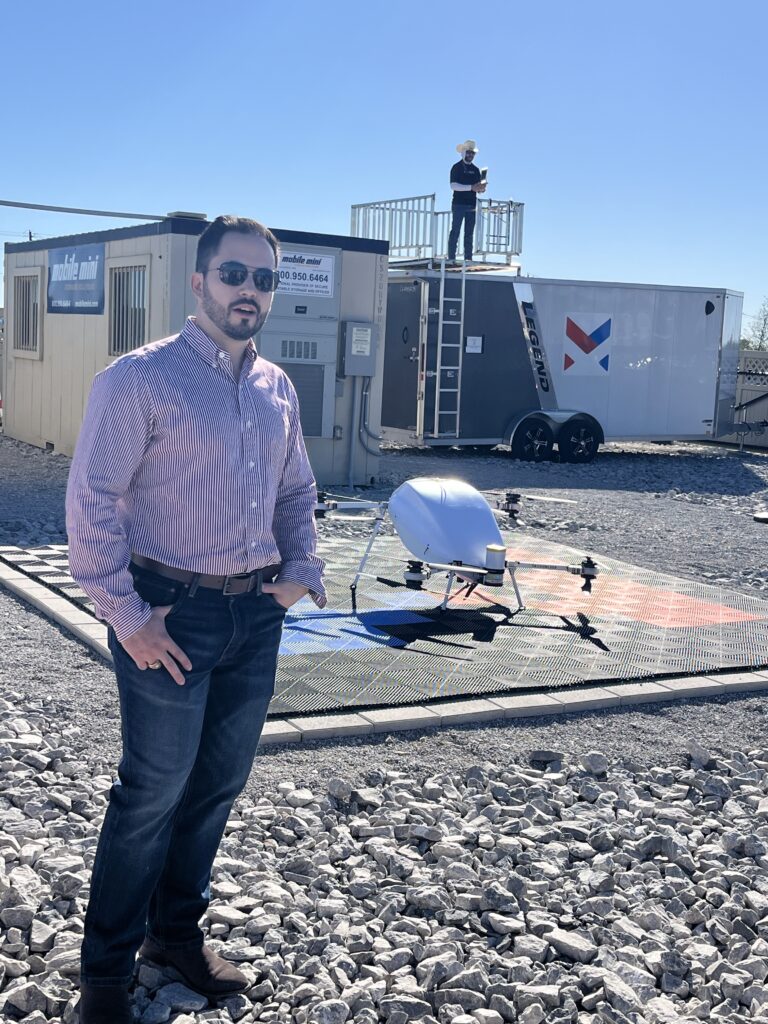
Most sites have defined launch and recovery zones, secured perimeters, and battery storage.
Lack of Transparency: The Missing Map
For legacy aircraft, these “structures” would fall under heliport or airport design and operational guidance. But FAA Form 7480-1, which initiates aeronautical studies for such infrastructure, has no provision for droneports. Without that mechanism, there is no way to trigger an airspace review or chart these sites in the National Airspace System (NAS) for awareness to other airspace users. This lack of visibility creates operational risk for those who depend on low-altitude airspace, including helicopter and agricultural pilots.
Operational Suitability On the Fly
Even where precautions are taken, such as visual observers, fencing, or detect-and-avoid systems, there is no shared framework for assessing or siting supporting infrastructure. While it may be reasonable for command and control and detect-and-avoid (DAA) configurations to vary depending on mission or manufacturer, the physical location of this infrastructure should still follow basic principles of operational suitability. In aviation, elements like wind cones, beacons, and communications equipment are sited with precision to avoid becoming hazards themselves. That kind of intentionality is missing here.
Clearing the Air On Potential Fire Hazards
Battery storage is one area where the absence of clear standards is especially apparent. Environmental assessments for several operational sites reference lithium-ion batteries and backup generators, but rarely quantify how many are stored, how they are arranged, or whether minimum separation distances are considered. Some sites also include on-site fuel storage, yet the spatial relationship between these systems is often not described. The issue is that such standards do not currently exist. At heliports or airports, this level of planning would be routine. At droneports, it remains undefined.
“You ask the questions like, what’s the fire safety criteria for a droneport on a building?” said Five-Alph’s Alexander. “One of the trigger points has got to be the number of these lithium-ion batteries in a location. What’s that mean from a fire code standpoint? Are they stored in something with a fire rating? What do you have for training, for fire safety? And do you have an emergency action plan when something bad happens?”
Ready For Incident Response Readiness
This is not just a facility concern. It is a matter of community readiness. At heliports, standard operating procedures often include memorandums of understanding with local fire and police departments to clarify roles during an emergency. Like heliports, droneports do not have on-site response capabilities. If a thermal runaway or battery fire occurs, local responders are the first line of defense. Standardized design helps define expectations and can streamline response across jurisdictions. If these were heliports, the standards would be obvious. Because “droneport” remains undefined, the oversight does too.
Detroit’s Infrastructure-First Approach to Droneports
Many droneport efforts across the U.S. have emerged in reaction to specific waivers or operational needs. Michigan Central is taking a different approach, treating infrastructure as foundational rather than reactive. Instead of waiting for drone operations to scale, Detroit is building toward scale through deliberate infrastructure investments, cross-sector coordination, and a flexible UTM architecture designed for multiple missions and users.
The Advanced Aerial Innovation Region spans a three-mile urban test zone anchored at Michigan Central. With significant investment from the State of Michigan, the initiative supports the design, deployment, and real-world testing of drone technologies under both VLOS and BVLOS conditions.
At the core of this ecosystem is the Launchpad, a rooftop droneport adjacent to Newlab’s prototyping and workspace hub. The Launchpad supports both drone-in-a-box systems and free-flight operations. It operates under a temporary field permit issued by MDOT Aeronautics and is monitored in real time from the 12th-floor operations center at Michigan Central, which provides line-of-sight oversight and integrated support.
Located adjacent to Michigan Central, the Scaled Launch Facility offers a half-acre outdoor test environment designed for more complex drone operations. Its proximity to active and inactive rail corridors creates a natural shielded airspace for testing longer-range or infrastructure-focused missions. The facility includes enclosed, climate-controlled bays where operators can stage, maintain, and monitor their systems. Access is managed through flexible license agreements, allowing multiple users to share the site without the need for permanent leasing. Like the Launchpad, the facility is fully integrated with the AAIR UTM network, offering shared services for command and control, surveillance, Remote ID, and ADS-B coverage.
Rethinking the Operator-Specific Model
The prevailing model today often requires each aircraft operator to develop its own launch and recovery sites, tailored to proprietary systems or individual operational needs. While this approach may work in an early-stage, low-volume operational environment, it is unlikely to scale effectively. In traditional aviation, shared airport infrastructure enables interoperability and efficient resource allocation. Without a similar approach in urban drone operations, the result could be fragmented infrastructure, increased costs, and avoidable community friction.
There will always be cases where operator-specific infrastructure makes sense, especially at points of origin like distribution centers or logistics hubs. But in destination environments, particularly urban centers where demand from various operators converges in the same areas, the need for shared infrastructure becomes essential. Dense, mixed-use housing and limited space for new infrastructure make a compelling case for consolidated, operator-agnostic droneports that can serve a range of aircraft and missions under one set of standards.
Operator-Agnostic Design and Downtown Potential
Detroit’s model prioritizes shared infrastructure from the outset. The droneports are not designed for a single user or use case. They support concurrent operations, accommodate various aircraft types and mission profiles, and offer digital and physical infrastructure.
Downtown Detroit presents a strong opportunity for this model to thrive. The urban environment offers multimodal corridors, critical infrastructure, water crossings, industrial zones, and high-density residential and commercial areas. These features create a dynamic but demanding operational context, one that requires collaboration over fragmentation.
As new droneport concepts emerge in and around Detroit, Michigan Central’s infrastructure-first and operator-agnostic approach offers a promising template. It is well suited not only for public partners and aviation stakeholders but also for real estate developers and property owners looking to align with the future of urban air operations. This model can serve as a foundation for scalable, sustainable growth built on shared access, integrated systems, and efficient land use.
Acknowledgment Is the First Step Toward Safer Integration
Whatever you want to call them, droneports exist today. Launch pads are built. Power and data has been wired in. Flights are happening in cities and suburbs across the country. The infrastructure came together without guidance because real demand materialized before the policy. While regulators focused on vertiports for aircraft still chasing certification, commercial drones have been flying missions from fixed sites for years. These facilities are real, as are the risks that arise from the lack of a framework to build, evaluate and sustain them. That is the disconnect. It is not one of intention, but rather of timing. Droneports are here. The FAA is advancing new operational frameworks, but it has yet to define the critical infrastructure that supports them. That gap leaves operators and communities potentially exposed to the same risks already playing out today.

