As wildfires become more frequent and severe across the globe, the need for advanced tools to predict, detect and respond to these disasters has become increasingly critical. At the 2025 Esri Safety and Security Summit (ES3) in San Diego, leaders from fire agencies, public safety organizations, and technology innovators gathered to share how Geographic Information Systems (GIS) continue to improve wildfire management. Their stories, drawn from the front lines in California, Australia and beyond, reveal a landscape where data-driven decisions, collaboration and community preparedness remain essential to saving lives and property.

The New Wildfire Reality
The past decade has seen wildfires escalate in both intensity and unpredictability. Drought, heatwaves and urban expansion into wildland areas have created a perfect storm for catastrophic events.
“Wildfires have become faster, more intense,” according to Dr. Lori Moore-Merrill, former U.S. Fire Administrator. “…We see the devastation…that often happens in the wildland space has now made its way into communities.”
This shift has forced agencies to rethink every aspect of wildfire response, from early detection to mass evacuations and recovery. GIS technology, once a specialized tool for mapping, now helps agencies integrate real-time data for, among other things, predictive modeling and community engagement.
Early Detection: Seeing Fires Before They Spread
The critical importance of early detection recurred as a theme throughout ES3. In California, the ALERTCalifornia program, based at UC San Diego, has deployed over 1,100 state-of-the-art cameras across the state to provide real-time situational awareness to first responders and firefighters. These cameras, equipped with near-infrared sensors and AI-assisted detection, allow fire agencies to spot ignitions in their earliest stages, often before they are reported by the public.
Professor Neal Driscoll, principal investigator for ALERTCalifornia, emphasized the value of partnerships in this endeavor. “We’re using AI now that’s attended by subject matter experts at CalFire,” he explained. “This knocks down the false positives. It removes the noise. We will always have a subject matter expert in the pipeline of whatever we do.”
The integration of these camera feeds with Esri’s ArcGIS Living Atlas allows agencies to overlay live imagery with weather, fuel and demographic data. Kevin Armstrong, Senior Solution Engineer at Esri, demonstrated how ArcGIS provides a live view for satellite-based wildfire detections with the exact location, date and time and further enriched data with information from its Living Atlas. This fusion of information enables rapid confirmation of fire incidents and immediate assessment of risks to people and infrastructure.

Modeling Fire Spread and Suppression
Beyond detection, GIS remains central to predicting how fires will behave and where they will spread. In Australia, Harry Smiles of the Country Fire Authority (CFA) described how he uses large-scale spatial analysis to optimize first attack capabilities in Victoria, one of the world’s most fire-prone regions. By modeling travel times for fire appliances and aircraft to thousands of grid points across the state, CFA can identify critical gaps in coverage and strategically deploy resources.
Smiles explained, “The best opportunity to bring a bushfire under control is…when they are small. The role of ‘first attack’ is to contain the fire swiftly and to minimize the risk to lives and property.”
This approach relies on detailed network analysis that factors in road speeds, resource availability and the time it takes for crews to get out the door. The result is a dynamic map that shows, minute by minute, where suppression efforts will likely succeed and where additional resources—such as ultra-heavy tankers or aircraft—might be needed.
In California, similar modeling is also possible thanks to partnerships between ALERTCalifornia, Esri and agencies like CalFire. Fire progression models, such as those developed by FlameMapper, can ingest real-time data on ignition points, wind, topography and vegetation to produce hour-by-hour forecasts of fire spread. These predictions inform decisions about evacuations, resource allocation and public warnings.
The Human Factor: Evacuation and Community Safety
While technology provides powerful tools, the human element remains central to wildfire response. Nowhere is this more evident than in the challenge of mass evacuations during fast-moving fires. The panel on evacuation strategies, moderated by Dr. Moore-Merrill, brought together fire chiefs, law enforcement and GIS analysts to discuss the realities on the ground.
Chief Kevin Fetterman of the Orange County Fire Authority described the early moments of a wildfire: “The fire starts, our units arrive, our command vehicles arrive, and the incident commanders unify incident commanders from local agencies… We’re starting to look at the incident at the event, and we have a lot better tools now with…satellites…and the a whole suite of applications that provide the information that we’ve wanted for 50 years.”
Evacuation decisions are rarely straightforward. Law enforcement agencies, who hold statutory authority for evacuations, rely on fire modeling and GIS data to determine which neighborhoods are at risk and how best to move people to safety. Applications built on ArcGIS allow deputies to track which homes have been contacted, who has evacuated and where traffic bottlenecks may occur. Sergeant Kyle Glozer of the San Bernardino Sheriff’s Department highlighted that the app they use is “pretty simple.” It allows officers to mark residents as “leaving, evacuating, or no answer at the door.” In rural areas, where connectivity is limited, agencies fall back on pre-printed maps and in-person coordination.

Data Integration: The Backbone of Modern Response
Another consistent message throughout ES3 was that data integration is not just a technical challenge—it’s a cultural one. Wildfire response involves dozens of agencies, each with its own systems, data formats and operational priorities. GIS provides a shared conceptual framework for bringing this information together. This allows for rapid application development, real-time dashboards and a single source of truth for decision-makers.
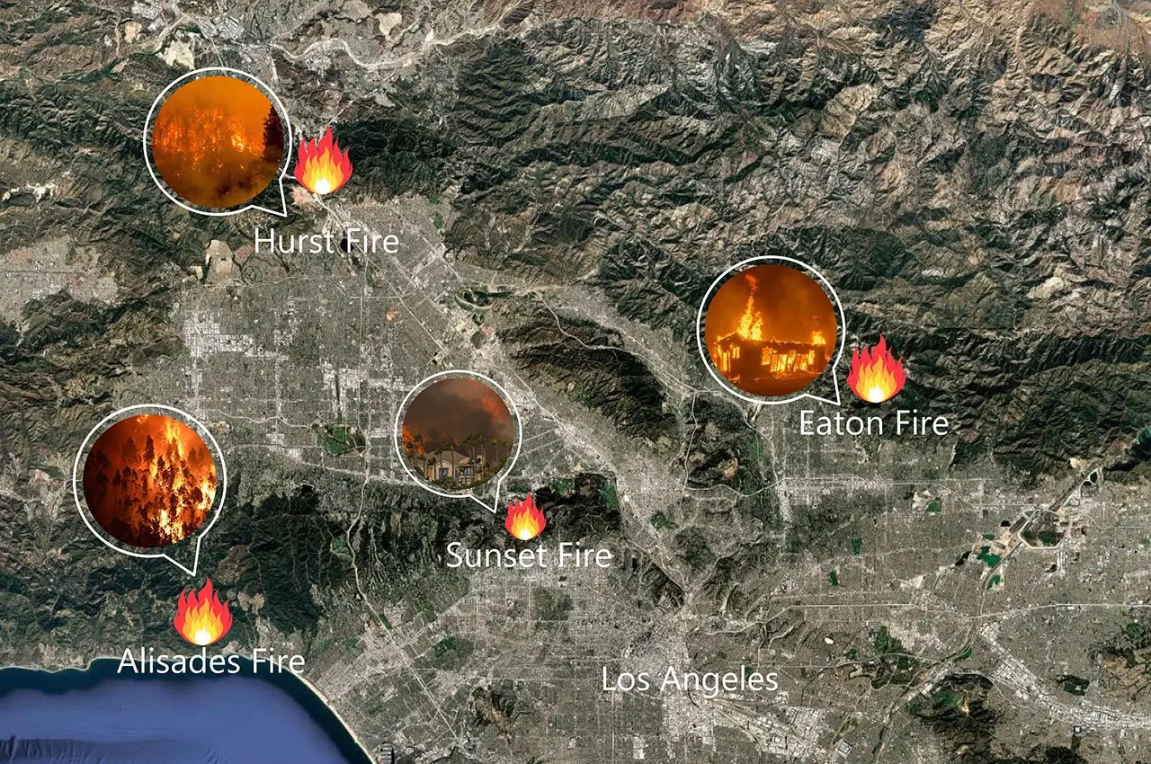
Mark Greninger, GIS Manager for Los Angeles County Public Works, recounted the experience of responding to the Eaton and Palisades fires, among the most expensive natural disasters in California history. The data exceeded the ability of the normal incident command system.
“This was a huge event… multiple jurisdictions, multiple agencies, and hundreds of staff across all these agencies,” he recalled. “The one thing that you can probably imagine, the problem that we run into with all of these agencies coming in is there’s so much information, there’s so many responses going on. We couldn’t keep control of it,” he said. Until they did.
By leveraging ArcGIS Online and open data hubs, Greninger’s team was able to provide real-time maps of infrastructure, damage assessment and debris removal, accessible to all partners and the public. He described this important use case as “really powerful.”
Recovery and Rebuilding: GIS Beyond the Flames
The role of GIS does not end when firefighters extinguish the last embers. In the aftermath of wildfires, communities face the daunting tasks of assessing damage, removing debris and rebuilding homes and infrastructure. GIS platforms provide the tools to track progress, prioritize resources and ensure transparency.
In Los Angeles County, aerial imagery and parcel data helped environmental teams identify properties eligible for federal assistance, while public-facing apps gave residents up-to-date information on the status of their neighborhoods. As noted above, dashboards built on ArcGIS allowed officials to monitor the number of structures damaged or destroyed, track debris removal operations, and coordinate the restoration of utilities.
Greninger noted, “We built a dashboard…for our operations…Political boundaries, our jurisdictional boundaries, are really critical to our residents. Who’s responsible for what?” ArcGIS allowed his team to show locations of the fire boundaries and granular neighborhood data. “This became a huge advantage for communicating to the public,” he said.

Education, Consistency and the Road Ahead
As agencies continue to refine their approaches, the importance of public education and consistent messaging has become clear. Many residents do not know if they live in a wildland-urban interface (WUI), or what evacuation warnings mean for their specific location. While GIS tools that map ember zones, end zones, and evacuation routes are helping to close this gap, ongoing outreach and drills remain essential.
The summit also highlighted the need for continued collaboration, both within and across agencies. As Chief Fetterman observed, “All these solutions start with collaboration between partners…and the technology ecosystem. So keep working together. And we’ll get better solutions.”
A Data-Driven Future for Wildfire Management
The Esri Safety and Security Summit made clear that the future of wildfire management will continue to be shaped by those who can harness data, foster partnerships and adapt to changing threats. GIS is no longer a back-office tool. It has become the nervous system of modern wildfire response that connects sensors, analysts, field crews and communities in a shared mission to protect lives and landscapes.
As wildfires continue to test the resilience of communities from California to Australia, the lessons from ES3 offer a blueprint for action: invest in early detection, model risks in real time, integrate data across agencies and never lose sight of the people at the heart of every response. In the words of Professor Driscoll, “It takes a village.” The task ahead may seem immense, but the right GIS tools, combined with training and cooperation, will pave the way to safer, more resilient communities.
By: Dawn Zoldi