By: Dawn Zoldi
Navigating the modern world, whether by autonomous car, unmanned aerial system (UAS), uncrewed underwater vehicle (UUV) or warehouse robot, demands exceptional precision. This is especially true in places where GPS signals falter, such as in urban canyons, subsurfaces or on jammed battlefields. In these high-stakes autonomy environments, even a millisecond of drift can mean the difference between mission success and failure.
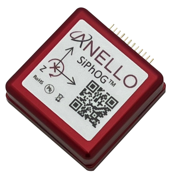
At the intersection of photon physics and silicon engineering, ANELLO Photonics has redefined what’s possible with its miniaturized optical gyroscope technology. The company’s breakthrough Silicon Photonics Optical Gyroscope – SiPhOG™ delivers navigation-grade accuracy in a package small enough for mass deployment. Explore ANELLO’s breakthrough platforms, field applications and why their “rings” of light have charted a new course for resilient, scalable autonomy across a wide range of industries.
The Making Of A Postage‑Stamp Gyro With Navigation‑Grade Drift
Based in Santa Clara, California, ANELLO Photonics has built a compact optical gyroscope platform around silicon photonics that supplies navigation-grade precision in a small enough size-weight-and-power+cost (SWaP-C) footprint to enable its widespread use across land, air, sea and robotics domains. (Fun Fact: ANELLO means “ring” in Italian, a nod to the Sagnac interferometer at the heart of optical gyros and to the company’s mission of putting fiber optic based precision on a chip for real-world autonomy where GPS is unreliable or unavailable).
Santa Clara Roots
Co-founders Dr. Mario Paniccia and Mike Horton met by chance through a mutual colleague and fused their individual deep expertise to create this new class of inertial sensors. Paniccia brings two decades leading silicon photonics at Intel and Horton from decades in Micro-Electro-Mechanical Systems (MEMS – miniature sensors and actuators fabricated from silicon that serve as the low-cost, high-volume gyroscopes and accelerometers inside smartphones, wearables and many consumer and industrial devices), gyros and navigation as Crossbow co-founder.
The partners launched ANELLO in late 2019. Since then, the company has accelerated from a four-person startup through pandemic-era challenges that has amassed a unique patent portfolio (more than 40 issued and over 44 pending patents) and won major contracts, and shipping to customers serving defense, industrial and autonomous systems worldwide.
Why SWaP‑C Matters for Autonomy
Traditional high-precision Fiber Optic Gyroscopes (FOGs – a highly precise rotation sensor that uses coils of optical fiber and the interference of laser light to measure orientation and angular velocity common in aerospace, ship, and vehicle navigation systems where accurate, low-drift guidance is essential) carry excellent drift but are too big, heavy, and expensive for battery-limited drones, compact robots and cost-sensitive fleets. On the other hand, MEMS gyros are small and cheap but struggle with bias, temperature, vibration and electro-magnetic interference (EMI). This makes them fragile in tunnels, urban canyons, weld yards and contested radio frequency (RF) environments. ANELLO’s SiPhOG (short for Silicon Photonics Optical Gyroscope), which took four years to develop, threads the needle.
The SiPhOG Difference

The SiPhOG closes the gap between bulky FOGs and drift-prone MEMS by integrating splitters, couplers, modulators, detectors, polarizers and a low-loss on-chip waveguide into a patented silicon photonic integrated circuit. It shrinks a tabletop interferometric FOG into a chip-scale module, powered at only 3.3 V. Because its signal carriers are photons, not capacitive plates or moving masses, it has low thermal, vibration, and EMI sensitivity.
The optical Photonic Integrated Circuit (PIC – a type of chip that integrates multiple photonic or light-based components) itself is on the order of a few millimeters (roughly 2 mm by 5 mm). This makes the complete sensor module small enough to be described as “a little bigger than a postage stamp,” yet still capable of sub–0.5°/hr bias instability. This level of accuracy was previously reserved for coffee-can-sized FOGs, such as those found in fighter jets and submarines.
It provides navigation-grade drift by enabling the three key units below, fused with inertial measurements to deliver robust navigation and heading even when satellite signals are degraded, denied, or spoofed:
- Inertial Measurement Unit (IMU) – an electronic device equipped with accelerometers and gyroscopes that measures and reports specific force, angular rate, and sometimes orientation in three dimensions.
- Inertial Navigation System (INS) – a navigation platform that combines an IMU with algorithms and reference points (sometimes including magnetometers and GNSS) to calculate and output the real-time position, vector, attitude, and velocity of a moving object.
- Global Navigation Satellite System/Inertial Navigation System (GNSS/INS) – in which satellite positioning data (e.g., GPS, Galileo) is fused with inertial measurements from an INS to deliver robust navigation and heading even when satellite signals are degraded, denied, or spoofed
This keeps vehicles on heading for tens of minutes and tens of kilometers with minimal lateral error, even when GPS is unavailable or when GPS is jammed or spoofed. Paniccia said, “When GNSS says you’re in Texas but your inertial says you moved 100 meters, you’re being spoofed—so we immediately rely on the gyro.” Tested algorithms have demonstrated 100 km of driving with about 100 m lateral error without GPS. This translates to about 99.9% path fidelity, depending on the scenario and error metric used.
The result is a practical inertial backbone that continuously cross-checks GNSS; when signals degrade or are manipulated, ANELLO’s sensor fusion shifts weighting to inertial, flags spoofing by comparing inertial deltas to GNSS jumps and preserves guidance until clean sky returns.
Land, Robots, Air, Sea: One Inertial Backbone for All Dual-Use Autonomous Systems
From orchards with dense canopy to construction sites with weld spatter and EMI, ANELLO is shipping SiPhOG-based solutions into industrial fleets. The same inertial backbone that hardens drones against RFI helps autonomous tractors spray in GPS‑shadow rows, survey rigs map urban canyons, and AUVs execute repeatable patterns between surfacings. ANELLO compresses programs across domains that once needed disparate, domain‑specific hardware.
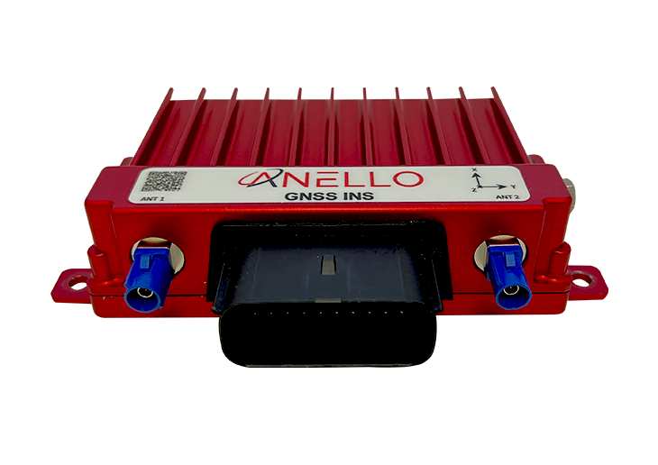
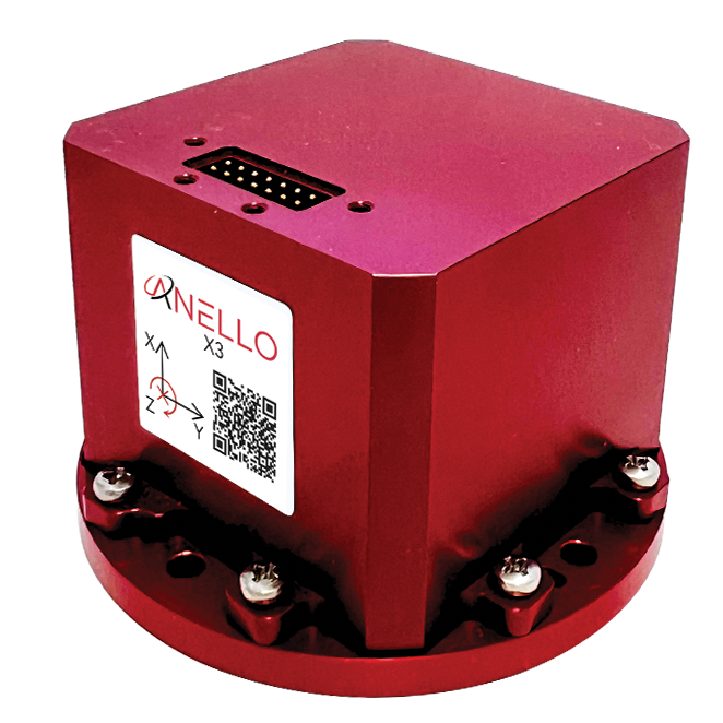
ANELLO’s platform ships as single‑axis GNSS/INS and IMU+ for rugged robotics, and as the X3, a tri‑axis IMU that packages three SiPhOGs into a cube smaller than a Rubik’s Cube and under 8 in³, less than 0.5 lb, and under 5 W, to enable three‑dimensional motion sensing for drones and other unmanned aerial systems where every gram and watt matters. Additionally, ANELLO also offers a Maritime INS with three SiPhOGs and a higher grade triple-band GNSS Receiver for USVs and other autonomous maritime systems.
Land: Resilient Road Heading

Urban canyons, tunnels, tree canopies (think: apple orchards) and construction sites cause multipath, occlusion and periodic loss of GNSS, while vibration, weld noise, and EMI degrade consumer‑grade IMUs, leading to drift and lane‑keeping errors during outages.
ANELLO’s single‑axis GNSS/INS integrates accelerometers, triple‑redundant MEMS for coarse alignment, temperature sensors and sealed IP‑rated enclosures to provide land platforms with robust heading and dead‑reckoning even after GNSS fades. The GNSS/INS uses the optical heading as the primary truth when GNSS quality drops. It blends with wheel odometry and accelerometers to maintain < 0.5°/hr drift and achieve about 0.1% distance error over extended outages. It can guide land vehicles during 30–60 minutes of driving and 100 km traversals with roughly 100 m lateral error.
The return on investment (ROI) in this domain includes fleet uptime and improved safety. Vehicles retain routing and lane‑level guidance through GNSS gaps, which avoids pull‑over events and schedule hits. It also helps contain cost because SiPhOG brings navigation‑grade inertial into a compact, low‑power module that installs in under 20 minutes per vehicle.
Robots: Dependable Indoor Autonomy
Warehouses, greenhouses, hospitals and parking structures are all GPS‑denied. Reflective glass, RF noise and heavy machinery in these environments stress MEMS IMUs and visual odometry, which produces drift and failsafes that stop robots mid‑mission.
ANELLO’s IMU+ brings the same SiPhOG inertial core performance without GNSS silicon into hardened enclosures for indoor and industrial Autonomous Mobile Robots (AMRs), excavators and weld cells. It maintains heading and position through dust, EMI and vibration where RF and cameras falter. As a result, mission completion rates rise and downtime falls. AMRs and autonomous equipment finish routes without network beacons or fiducials. ANELLO cuts rework and manual escorts while preserving precise repeatability.
Air: GPS‑Jam Survival for Drones

Drones routinely lose GNSS from canopy, buildings or deliberate jamming/spoofing. Without a reliable inertial backbone, return-to-home (RTH) fails and aircraft descend or crash, a phenomenon widely observed in conflict zones and dense cities.
The X3 achieves navigation-grade bias stability across all axes in a package small enough to ride on multirotor arms without meaningfully eroding flight time. This differentiates ANELLO versus legacy optical gyros, which could rob 15 minutes from a 30‑minute sortie due to weight and power.
The tri‑axis IMU keeps multirotors and fixed‑wing UAVs on heading and on mission through jammed corridors by automatically shifting navigation reliance to inertial, then smoothly handing back to GNSS when signals recover. This capability has been validated in Department of Defense (DoD) testing at ranges like White Sands Missile Range. Published X3 performance includes < 0.5°/hr gyro bias instability, < 0.05°/√hr ARW, and < 20 μg accel bias instability. It also delivers navigation-grade quality with interfaces like RS‑422 or UART for straightforward integration into autopilots and robotics stacks.
The value add? Operators reduce loss rates, sustain intelligence surveillance and reconnaissance (ISR) coverage, complete deliveries and maintain beyond visual line of sight (BVLOS corridors). In short, ANELLO protects high‑value airborne payloads, airframes and mission sets.
Sea: Inertial Where Satellites Can’t Go
Below a few feet of water, GNSS disappears. On the surface, wave action and look‑alike horizons confound cameras and LiDAR. All of these challenges make low‑cost navigation at the surface and subsea a longstanding pain point. SiPhOG-based IMUs provide stable heading and low drift for USVs in swell and AUVs underwater. They provide dead‑reckoning legs between surfacings or acoustic fixes while keeping power budgets tight for small hulls. This expands coverage and improves fuel or battery use, because vehicles stay on track without frequent surfacing or expensive high‑end FOGs. ANELLO also enables seaborne multi‑vehicle swarms and portable kits for survey, inspection, and security.
What’s Next in 2026: Smaller, Lighter, Everywhere
Expect continued reductions in SWaP, broader production of tri‑axis units and expanded productization of man‑portable and soldier‑worn navigation sets built on the SiPhOG core. All of this aligns with customer demand for GPS‑independent position navigation and timing (PNT) at the edge. ANELLO also foreshadowed new use‑case announcements around the upcoming Consumer Electronics Show (CES). Finally, keep an eye out for deeper domain integrations, where the SiPhOG core embeds in even more compact modules and, ultimately, consumer‑scale devices in the future. ANELLO’s goal: for every soldier, every responder, every robot everything and anything that moves to have ANELLO on board or inside.
Watch Dr. Mario Paniccia on the Dawn of Autonomy Podcast, Episode 95.

